Wareham, Massachusetts Map and Directory
Regional Directory > States Menu > Massachusetts
 According to the United States Census Bureau, Wareham is a Town that is located in Plymouth County, Massachusetts at 41.76 degrees North and 70.70 degrees West.
The town's time zone is America/New York, and the town's primary telephone area code is 774.
The land area of Wareham is about 35.86 square miles, whereas the water area of the town is about 10.43 square miles.
Plymouth County's land area is about 659 square miles, so the town occupies about 5.4 percent of the county's total land area.
According to the United States Census Bureau, Wareham is a Town that is located in Plymouth County, Massachusetts at 41.76 degrees North and 70.70 degrees West.
The town's time zone is America/New York, and the town's primary telephone area code is 774.
The land area of Wareham is about 35.86 square miles, whereas the water area of the town is about 10.43 square miles.
Plymouth County's land area is about 659 square miles, so the town occupies about 5.4 percent of the county's total land area.
The Census Bureau estimates that Wareham had about 22,641 residents in 2019, which is approximately 631 people per square mile of land area.
According to recent American Community Survey data, the median household income in Wareham was about $65,825 per year.
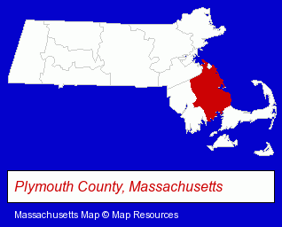
The Massachusetts counties map at upper right shows Plymouth County, highlighted in red. Use the menu below to display interactive maps of Wareham, either in a frame on this page or in full-screen mode.
Use the menu below to display categorized Wareham directories.
| Wareham Directory Page: | Dentists |
|---|
Selected Wareham, Massachusetts Listings
These Wareham listings provide some insight into the town's cultural environment and economic climate.- Restaurants
- Pizza Restaurants
- American Restaurants
- Bar & Grill Restaurants
- Family Restaurants
- Marine Professionals & Services
- Ship Building & Repair
- Boat Builders & Wholesalers
- Ship Building & Repair
- Boat Builders & Wholesalers
- Physicians & Surgeons
- Chiropractors
- General Practice
- Builders & Contractors
- Building Contractors
- Carpenters
- Handy Person Services
- Hospice Services
- Metal Products Wholesale & Manufacturers
- Department Stores
- Boat Dealers
- Florists
- Fruit Baskets
- Landscape Contractors
- Tree Services Commercial & Industrial
- Coffee & Tea Shops
- Cultural Attractions, Events & Facilities
- Libraries
- Attorneys
Nearby Massachusetts Cities and Towns *
- Hanover (3) - Hanover, Massachusetts information and maps.
- New Bedford (15) - New Bedford, Massachusetts demographics and directory.
- Plymouth (16) - Plymouth, Massachusetts demographics and directory.
- Sandwich (3) - Sandwich, Massachusetts information and maps.
* Parenthesized numbers indicate economic activity levels.
Copyright © 2011-2026 RegionalDirectory.us. All rights reserved.