Rockland, Massachusetts Map and Directory
Regional Directory > States Menu > Massachusetts
 According to the United States Census Bureau, Rockland is a Town that is located in Plymouth County, Massachusetts at 42.13 degrees North and 70.91 degrees West.
The town's time zone is America/New York, and the town's primary telephone area code is 339.
The land area of Rockland is about 10.03 square miles, whereas the water area of the town is about 0.08 square miles.
Plymouth County's land area is about 659 square miles, so the town occupies about 1.5 percent of the county's total land area.
According to the United States Census Bureau, Rockland is a Town that is located in Plymouth County, Massachusetts at 42.13 degrees North and 70.91 degrees West.
The town's time zone is America/New York, and the town's primary telephone area code is 339.
The land area of Rockland is about 10.03 square miles, whereas the water area of the town is about 0.08 square miles.
Plymouth County's land area is about 659 square miles, so the town occupies about 1.5 percent of the county's total land area.
The Census Bureau estimates that Rockland had about 17,953 residents in 2019, which is approximately 1,790 people per square mile of land area.
According to recent American Community Survey data, the median household income in Rockland was about $78,011 per year.
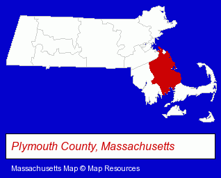
The Massachusetts counties map at upper right shows Plymouth County, highlighted in red. Use the menu below to display interactive maps of Rockland, either in a frame on this page or in full-screen mode.
Use the menu below to display categorized Rockland directories.
| Rockland Directory Page: | Home Improvement |
|---|
Selected Rockland, Massachusetts Listings
These Rockland listings provide some insight into the town's cultural environment and economic climate.- Building & Home Construction
- Floors & Flooring Contractors
- Floors & Flooring Installation
- Builders & Contractors
- Building Contractors
- Environmental Engineers
- Movers
- Financial Services
- Financing
- Industrial Equipment & Supplies Dealers
- Cleaning Services
- Industrial Equipment Rebuilding, Service & Repair
- Sewer & Drain Cleaning, Service & Repair
- Water Pollution Control Equipment & Systems
- Industrial Equipment & Supplies Dealers
- Industrial Equipment & Supplies Wholesale & Manufacturers
- Exporters
- Interior Decorators & Designers
- Wallpaper Removing Equipment Retail
- Medical Equipment & Supplies Retail
- Hospital Supplies
- Medical Equipment & Supplies Retail
- Fire Sprinkler Systems
- Mortgages
- Escrow Services
- Mortgage Brokers
- Industrial Equipment & Supplies Wholesale & Manufacturers
- Medical Equipment & Supplies Retail
- Industrial Equipment Parts & Accessories Wholesale & Manufacturers
- Plastic Molders
- Plastic Molds Manufacturers
- Cultural Attractions, Events & Facilities
- Libraries
- Laundries
- Linen Supply Services
- Auto Dealers
Nearby Massachusetts Cities and Towns *
- Brockton (15) - Brockton, Massachusetts demographics and directory.
- Cohasset (2) - Cohasset, Massachusetts information and maps.
- Hanover (3) - Hanover, Massachusetts information and maps.
- Hingham (5) - Hingham, Massachusetts demographics and maps.
- Quincy (17) - Quincy, Massachusetts solutions directory and maps.
- Randolph (2) - Randolph, Massachusetts information and maps.
- Stoughton (8) - Stoughton, Massachusetts demographics and maps.
* Parenthesized numbers indicate economic activity levels.
Copyright © 2011-2026 RegionalDirectory.us. All rights reserved.