Salem, Massachusetts Map and Directory
Regional Directory > States Menu > Massachusetts
 According to the United States Census Bureau, Salem is a City that is located in Essex County, Massachusetts at 42.52 degrees North and 70.90 degrees West.
The city's time zone is America/New York, and the city's primary telephone area code is 351.
The land area of Salem is about 8.28 square miles, whereas the water area of the city is about 10.01 square miles.
Essex County's land area is about 493 square miles, so the city occupies about 1.7 percent of the county's total land area.
According to the United States Census Bureau, Salem is a City that is located in Essex County, Massachusetts at 42.52 degrees North and 70.90 degrees West.
The city's time zone is America/New York, and the city's primary telephone area code is 351.
The land area of Salem is about 8.28 square miles, whereas the water area of the city is about 10.01 square miles.
Essex County's land area is about 493 square miles, so the city occupies about 1.7 percent of the county's total land area.
The Census Bureau estimates that Salem had about 43,226 residents in 2019, which is approximately 5,221 people per square mile of land area.
According to recent American Community Survey data, the median household income in Salem was about $68,808 per year.
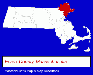
The Massachusetts counties map at upper right shows Essex County, highlighted in red. Use the menu below to display interactive maps of Salem, either in a frame on this page or in full-screen mode.
Use the menu below to display categorized Salem directories.
| Salem Products and Services Directory | ||
|---|---|---|
| Attorneys | Dentists | Information Technology |
| Insurance | Museums | Physicians |
| Printing and Publishing | Restaurants | Schools |
| Steak Restaurants | ||
Selected Salem, Massachusetts Listings
These randomly selected Salem listings provide some insight into the city's cultural environment and economic climate.- Contact Lenses
- Opticians
- Mexican Restaurants
- Spanish Restaurants
- Accountants
- Public Accountants
- Accounting, Auditing & Bookkeeping Services
- Drywall Contractors
- Industrial Equipment & Supplies Dealers
- Metals
- Metal Finishing
- Personal Injury Attorneys
- Accident Attorneys
- Wrongful Death Attorneys
- Family Law Attorneys
- Divorce Attorneys
- Custody & Support Law Attorneys
- Building & Home Construction
- Architects
- Architectural Services
- Take Out
- Delicatessens
- Movers
- Household Goods & Furniture Storage
- Building Contractors
- Construction Companies
- Building Construction & Design Consultants
- Child Care Services
- Preschools & Kindergartens
- Child Care Centers
- Child Development Centers
- Colleges & Universities
Nearby Massachusetts Cities and Towns *
- Beverly (7) - Beverly, Massachusetts demographics and maps.
- Danvers (9) - Danvers, Massachusetts demographics and directory.
- Lynn (3) - Lynn, Massachusetts information and maps.
- Melrose (3) - Melrose, Massachusetts information and maps.
- Peabody (14) - Peabody, Massachusetts demographics and directory.
- Saugus (3) - Saugus, Massachusetts information and maps.
- Wakefield (9) - Wakefield, Massachusetts demographics and directory.
* Parenthesized numbers indicate economic activity levels.
Copyright © 2011-2026 RegionalDirectory.us. All rights reserved.