Walpole, Massachusetts Map and Directory
Regional Directory > States Menu > Massachusetts
 According to the United States Census Bureau, Walpole is a Town that is located in Norfolk County, Massachusetts at 42.15 degrees North and 71.26 degrees West.
The town's time zone is America/New York, and the town's primary telephone area code is 774.
The land area of Walpole is about 20.43 square miles, whereas the water area of the town is about 0.62 square miles.
Norfolk County's land area is about 396 square miles, so the town occupies about 5.2 percent of the county's total land area.
According to the United States Census Bureau, Walpole is a Town that is located in Norfolk County, Massachusetts at 42.15 degrees North and 71.26 degrees West.
The town's time zone is America/New York, and the town's primary telephone area code is 774.
The land area of Walpole is about 20.43 square miles, whereas the water area of the town is about 0.62 square miles.
Norfolk County's land area is about 396 square miles, so the town occupies about 5.2 percent of the county's total land area.
The Census Bureau estimates that Walpole had about 25,129 residents in 2019, which is approximately 1,230 people per square mile of land area.
According to recent American Community Survey data, the median household income in Walpole was about $119,846 per year.
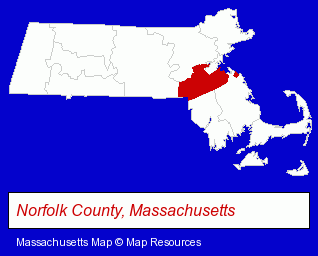
The Massachusetts counties map at upper right shows Norfolk County, highlighted in red. Use the menu below to display interactive maps of Walpole, either in a frame on this page or in full-screen mode.
Use the menu below to display categorized Walpole directories.
| Walpole Products and Services Directory | ||
|---|---|---|
| Business Services | Dry Cleaners | Home Improvement |
| Landscape Contractors | Restaurants | |
Selected Walpole, Massachusetts Listings
These randomly selected Walpole listings provide some insight into the town's cultural environment and economic climate.- Food Products Wholesale & Manufacturers
- Tax Attorneys
- Tax Consultants
- Dentists
- Florists
- Government Contractors
- Environmental Engineers
- Cleaning Services
- Clothing & Accessories Cleaning & Repair
- Dry Cleaners
- Physicians & Surgeons
- General Practice
- Industrial Equipment & Supplies Dealers
- Industrial Equipment & Supplies Wholesale & Manufacturers
- Importers
- Veterinarians
- Animal Hospitals
- Small Animal Veterinarians
- Preventive Medicine Veterinarians
- Internal Medicine Veterinarians
Nearby Massachusetts Cities and Towns *
- Canton (3) - Canton, Massachusetts information and maps.
- Dedham (8) - Dedham, Massachusetts demographics and maps.
- Natick (11) - Natick, Massachusetts demographics and directory.
- Needham (9) - Needham, Massachusetts demographics and directory.
- Norwood (10) - Norwood, Massachusetts demographics and directory.
- Stoughton (8) - Stoughton, Massachusetts demographics and maps.
- Wellesley (6) - Wellesley, Massachusetts demographics and maps.
* Parenthesized numbers indicate economic activity levels.
Copyright © 2011-2026 RegionalDirectory.us. All rights reserved.