Wellesley, Massachusetts Map and Directory
Regional Directory > States Menu > Massachusetts
 According to the United States Census Bureau, Wellesley is a Town that is located in Norfolk County, Massachusetts at 42.31 degrees North and 71.28 degrees West.
The town's time zone is America/New York, and the town's primary telephone area code is 339.
The land area of Wellesley is about 10.02 square miles, whereas the water area of the town is about 0.50 square miles.
Norfolk County's land area is about 396 square miles, so the town occupies about 2.5 percent of the county's total land area.
According to the United States Census Bureau, Wellesley is a Town that is located in Norfolk County, Massachusetts at 42.31 degrees North and 71.28 degrees West.
The town's time zone is America/New York, and the town's primary telephone area code is 339.
The land area of Wellesley is about 10.02 square miles, whereas the water area of the town is about 0.50 square miles.
Norfolk County's land area is about 396 square miles, so the town occupies about 2.5 percent of the county's total land area.
The Census Bureau estimates that Wellesley had about 28,747 residents in 2019, which is approximately 2,869 people per square mile of land area.
According to recent American Community Survey data, the median household income in Wellesley was about $197,132 per year.
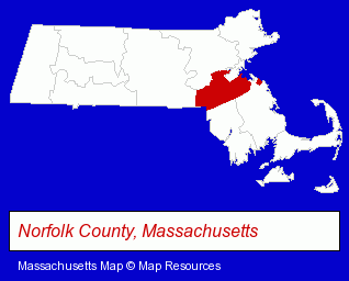
The Massachusetts counties map at upper right shows Norfolk County, highlighted in red. Use the menu below to display interactive maps of Wellesley, either in a frame on this page or in full-screen mode.
Use the menu below to display categorized Wellesley directories.
| Wellesley Products and Services Directory | ||
|---|---|---|
| Attorneys | Dentists | Gift Shops |
| Home Improvement | Physicians | Restaurants |
Selected Wellesley, Massachusetts Listings
These randomly selected Wellesley listings provide some insight into the town's cultural environment and economic climate.- Interior Decorators & Designers
- Estate Planning & Administration Attorneys
- Tax Attorneys
- Beauty Salons
- Hair Care & Treatment
- Skin Care Products
- Tanning Salons
- Skin Care Cosmetics
- Specialty Stores
- Specialty Stores
- Jewelers
- Family Law Attorneys
- Divorce Attorneys
- Custody & Support Law Attorneys
- Computer Consultants
- Computer Systems Consultants & Designers
- Banks
- Mortgages
- Charitable & Nonprofit Organizations
- Chambers of Commerce
Nearby Massachusetts Cities and Towns *
- Framingham (19) - Framingham, Massachusetts solutions directory and maps.
- Natick (11) - Natick, Massachusetts demographics and directory.
- Needham (9) - Needham, Massachusetts demographics and directory.
- Newton (11) - Newton, Massachusetts demographics and directory.
- Waltham (19) - Waltham, Massachusetts solutions directory and maps.
- Wayland (4) - Wayland, Massachusetts information and maps.
- Weston (1) - Weston, Massachusetts information and maps.
Large and Mid-size Cities in Nearby States
- Providence, Rhode Island (27) - Providence, RI solutions directory and maps.
- Nashua, New Hampshire (20) - Nashua, NH demographics and directory.
- Salem, New Hampshire (14) - Salem, NH demographics and directory.
* Parenthesized numbers indicate economic activity levels.
Copyright © 2011-2026 RegionalDirectory.us. All rights reserved.