Auburn Hills, Michigan Map and Directory
Regional Directory > States Menu > Michigan
 According to the United States Census Bureau, Auburn Hills is a City that is located in Oakland County, Michigan at 42.69 degrees North and 83.23 degrees West.
The city's time zone is America/Detroit, and the city's primary telephone area code is 248.
The land area of Auburn Hills is about 16.59 square miles, whereas the water area of the city is about 0.04 square miles.
Oakland County's land area is about 868 square miles, so the city occupies about 1.9 percent of the county's total land area.
According to the United States Census Bureau, Auburn Hills is a City that is located in Oakland County, Michigan at 42.69 degrees North and 83.23 degrees West.
The city's time zone is America/Detroit, and the city's primary telephone area code is 248.
The land area of Auburn Hills is about 16.59 square miles, whereas the water area of the city is about 0.04 square miles.
Oakland County's land area is about 868 square miles, so the city occupies about 1.9 percent of the county's total land area.
The Census Bureau estimates that Auburn Hills had about 24,748 residents in 2019, which is approximately 1,492 people per square mile of land area.
According to recent American Community Survey data, the median household income in Auburn Hills was about $64,186 per year.
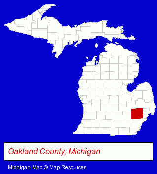
The Michigan counties map at upper right shows Oakland County, highlighted in red. Use the menu below to display interactive maps of Auburn Hills, either in a frame on this page or in full-screen mode.
Use the menu below to display categorized Auburn Hills directories.
| Auburn Hills Products and Services Directory | |
|---|---|
| Building Materials | Home Improvement |
Selected Auburn Hills, Michigan Listings
These representative Auburn Hills listings provide some insight into the city's cultural environment and economic climate.- Hair Care & Treatment
- Hair Replacement
- Wigs & Hairpieces Retail
- Public Accountants
- Outdoor Sports & Recreation
- Public Golf Courses
- Golf
- Golf Courses
- Private Golf Courses
- Coffee & Tea Shops
- Business Services
- Business Consultants & Advisors
- Management Consultants
- Business Management Services
- Door & Window Dealers
- Garage Doors & Openers
- Door & Door Frame Dealers
- Auto Body Repair & Painting
- Advertising
- Display Designers & Producers
- Carnivals, Fairs & Festivals
- Advertising Displays
- Convention & Trade Show Coordinators
- Advertising
- Electronic Equipment & Supplies Wholesale & Manufacturers
- Advertising Distribution Services
- Schools
- Elementary & Secondary Education
- Charitable & Nonprofit Organizations
- Elementary Schools
- Preschools & Kindergartens
- Moving & Storage
- Plastic & Plastic Products Wholesale & Manufacturers
- Vacuum & Pressure Forming Plastic Manufacturers
- Metals
- Plastic & Plastic Products Wholesale & Manufacturers
- Metal Finishing
- Plastic Fabrics, Film, Sheets & Rods Manufacturers
- Race Car Parts, Equipment & Supplies Retail
- Beauty Salons
- Hair Care & Treatment
- Manicures & Pedicures
Nearby Michigan Cities and Towns *
- Birmingham (10) - Birmingham, Michigan demographics and directory.
- Bloomfield Hills (6) - Bloomfield Hills, Michigan demographics and maps.
- Oxford (2) - Oxford, Michigan information and maps.
- Pontiac (3) - Pontiac, Michigan information and maps.
- Rochester (8) - Rochester, Michigan demographics and maps.
- Troy (23) - Troy, Michigan solutions directory and maps.
- Waterford (10) - Waterford, Michigan demographics and directory.
* Parenthesized numbers indicate economic activity levels.
Copyright © 2011-2026 RegionalDirectory.us. All rights reserved.