Benton Harbor, Michigan Map and Directory
Regional Directory > States Menu > Michigan
 According to the United States Census Bureau, Benton Harbor is a City that is located in Berrien County, Michigan at 42.12 degrees North and 86.45 degrees West.
The city's time zone is America/Detroit, and the city's primary telephone area code is 269.
The land area of Benton Harbor is about 4.43 square miles, whereas the water area of the city is about 0.25 square miles.
Berrien County's land area is about 568 square miles, so the city occupies about 0.8 percent of the county's total land area.
According to the United States Census Bureau, Benton Harbor is a City that is located in Berrien County, Michigan at 42.12 degrees North and 86.45 degrees West.
The city's time zone is America/Detroit, and the city's primary telephone area code is 269.
The land area of Benton Harbor is about 4.43 square miles, whereas the water area of the city is about 0.25 square miles.
Berrien County's land area is about 568 square miles, so the city occupies about 0.8 percent of the county's total land area.
The Census Bureau estimates that Benton Harbor had about 9,741 residents in 2019, which is approximately 2,199 people per square mile of land area.
According to recent American Community Survey data, the median household income in Benton Harbor was about $21,916 per year.
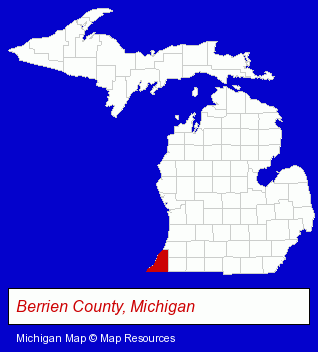
The Michigan counties map at upper right shows Berrien County, highlighted in red. Use the menu below to display interactive maps of Benton Harbor, either in a frame on this page or in full-screen mode.
Use the menu below to display categorized Benton Harbor directories.
| Benton Harbor Products and Services Directory | |
|---|---|
| Computer Printers | Metals |
Selected Benton Harbor, Michigan Listings
These representative Benton Harbor listings provide some insight into the city's cultural environment and economic climate.- Elementary & Secondary Education
- Elementary Schools
- Colleges & Universities
- Business Services
- Business Consultants & Advisors
- Chambers of Commerce
- Insurance
- Health Insurance
- Life Insurance
- Health Care Plans
- Pet Care Services
- Animal Shelters
- Pet Related Services
- Humane Societies
- Pet Adoption
- Engineers
- Metal Stamping
- Manufacturing Engineers
- Industrial Equipment & Supplies Wholesale & Manufacturers
- Tool & Die Makers
- Industrial Equipment & Supplies Wholesale & Manufacturers
- Tool & Die Makers
- Printing & Publishing
- Printing Services
- Commercial Printing
- Computer Printers
- Computer Supplies, Parts & Accessories
- Security Systems & Services
- Investigation Services
- Private Investigators
- Private Detectives
- Sporting Goods Dealers
- Fishing Equipment & Supplies Dealers
- Fishing Bait & Tackle
- Fishing Tackle Repair
- Metal Finishing
- Metal Polishing, Buffing & Plating
- Hobbies
- Hobby & Model Stores
- Toys Wholesale & Manufacturers
- Hobby & Model Supplies Wholesale & Manufacturers
- Auto Parts Wholesale & Manufacturers
- Metal Stamping
Nearby Michigan Cities and Towns *
- Berrien Springs (1) - Berrien Springs, Michigan information and maps.
- Coloma (1) - Coloma, Michigan information and maps.
- Dowagiac (1) - Dowagiac, Michigan information and maps.
- Kalamazoo (27) - Kalamazoo, Michigan solutions directory and maps.
- Niles (2) - Niles, Michigan information and maps.
- Saugatuck (2) - Saugatuck, Michigan information and maps.
- Stevensville (1) - Stevensville, Michigan information and maps.
Large and Mid-size Cities in Nearby States
- South Bend, Indiana (26) - South Bend, IN solutions directory and maps.
* Parenthesized numbers indicate economic activity levels.
Copyright © 2011-2026 RegionalDirectory.us. All rights reserved.