Cadillac, Michigan Map and Directory
Regional Directory > States Menu > Michigan
 According to the United States Census Bureau, Cadillac is a City that is located in Wexford County, Michigan at 44.25 degrees North and 85.40 degrees West.
The city's time zone is America/Detroit, and the city's primary telephone area code is 231.
The land area of Cadillac is about 7.56 square miles, whereas the water area of the city is about 1.86 square miles.
Wexford County's land area is about 565 square miles, so the city occupies about 1.3 percent of the county's total land area.
According to the United States Census Bureau, Cadillac is a City that is located in Wexford County, Michigan at 44.25 degrees North and 85.40 degrees West.
The city's time zone is America/Detroit, and the city's primary telephone area code is 231.
The land area of Cadillac is about 7.56 square miles, whereas the water area of the city is about 1.86 square miles.
Wexford County's land area is about 565 square miles, so the city occupies about 1.3 percent of the county's total land area.
The Census Bureau estimates that Cadillac had about 10,497 residents in 2019, which is approximately 1,388 people per square mile of land area.
According to recent American Community Survey data, the median household income in Cadillac was about $36,734 per year.
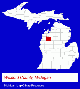
The Michigan counties map at upper right shows Wexford County, highlighted in red. Use the menu below to display interactive maps of Cadillac, either in a frame on this page or in full-screen mode.
Use the menu below to display categorized Cadillac directories.
| Cadillac Products and Services Directory | ||
|---|---|---|
| Building Materials | Home Improvement | Metals |
| Schools | ||
Selected Cadillac, Michigan Listings
These randomly selected Cadillac listings provide some insight into the city's cultural environment and economic climate.- Insurance
- Charitable & Nonprofit Organizations
- Auto Dealers
- Community & Civic Organizations
- Charitable, Educational & Research Foundations
- Information Technology Services
- Computer & Equipment Dealers
- Computers & Equipment Repair & Maintenance
- Consumer Electronics Stores
- Computer Supplies, Parts & Accessories
- Physicians & Surgeons
- Family & General Practice Physicians & Surgeons
- Auto Parts Wholesale & Manufacturers
- Tires Wholesale & Manufacturers
- Door & Window Dealers
- Docks
- Charitable & Nonprofit Organizations
- Metals
- Rehabilitation Services
- Metal Finishing
- Metal Stamping
- Auto Parts Retail
- Electric & Electronic Equipment & Supplies
- Home Furnishings Stores
- Furniture Stores
- Home Improvement Stores
- Hardware Dealers
- Industrial Equipment & Supplies Dealers
- Machine Shops
- CNC Machining, Turning & Milling Shops
- Machine Tool Dealers
- Elementary & Secondary Education
- Elementary Schools
- Private Schools
- Religious Education Schools
- Ski Shops
- Snowboard Sales & Rental
- Public Schools
Nearby Michigan Cities and Towns *
- Charlevoix (2) - Charlevoix, Michigan information and maps.
- Gaylord (3) - Gaylord, Michigan information and maps.
- Ludington (2) - Ludington, Michigan information and maps.
- Traverse City (30) - Traverse City, Michigan solutions directory and maps.
* Parenthesized numbers indicate economic activity levels.
Copyright © 2011-2026 RegionalDirectory.us. All rights reserved.