Albert Lea, Minnesota Map and Directory
Regional Directory > States Menu > Minnesota
 According to the United States Census Bureau, Albert Lea is a City that is located in Freeborn County, Minnesota at 43.65 degrees North and 93.37 degrees West.
The city's time zone is America/Chicago, and the city's primary telephone area code is 507.
The land area of Albert Lea is about 13.10 square miles, whereas the water area of the city is about 1.83 square miles.
Freeborn County's land area is about 707 square miles, so the city occupies about 1.9 percent of the county's total land area.
According to the United States Census Bureau, Albert Lea is a City that is located in Freeborn County, Minnesota at 43.65 degrees North and 93.37 degrees West.
The city's time zone is America/Chicago, and the city's primary telephone area code is 507.
The land area of Albert Lea is about 13.10 square miles, whereas the water area of the city is about 1.83 square miles.
Freeborn County's land area is about 707 square miles, so the city occupies about 1.9 percent of the county's total land area.
The Census Bureau estimates that Albert Lea had about 17,656 residents in 2019, which is approximately 1,348 people per square mile of land area.
According to recent American Community Survey data, the median household income in Albert Lea was about $47,508 per year.
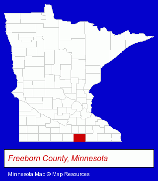
The Minnesota counties map at upper right shows Freeborn County, highlighted in red. Use the menu below to display interactive maps of Albert Lea, either in a frame on this page or in full-screen mode.
Use the menu below to display categorized Albert Lea directories.
| Albert Lea Directory Page: | Auto Service |
|---|
Selected Albert Lea, Minnesota Listings
These Albert Lea listings provide some insight into the city's cultural environment and economic climate.- Business Consultants & Advisors
- Charitable & Nonprofit Organizations
- Economic Development Agencies
- Lawn & Garden Equipment & Supplies Retail
- Fabric Shops
- Draperies & Curtains Retail
- Drapery & Curtain Fabrics Retail
- Restaurants
- Take Out
- Food & Beverage Services
- Food & Beverage Delivery Services
- Chinese Restaurants
- Charitable & Nonprofit Organizations
- Utilities
- Electric Companies
- Radio Stations
- Sporting Goods Dealers
- Boat Dealers
- Motorcycle, Motor Scooter & Minibike Dealers
- Snowmobile Dealers
- Truck Dealers
- Truck Body Repair & Painting
- Gift Shops
- Gift Baskets & Packs Retail
- General Merchandise Wholesale
- Gifts Wholesale & Manufacturers
- Churches
- Schools
- Private Schools
- Catholic Churches
- Religious Education Schools
- Physicians & Surgeons
- Alternative Medicine
- Chiropractors
- Alternative Medicine Practitioners
- Acupuncture & Acupressure
- Charitable & Nonprofit Organizations
- Credit Unions
- Labor Organizations
Nearby Minnesota Cities and Towns *
- Blue Earth (1) - Blue Earth, Minnesota information and maps.
- Faribault (3) - Faribault, Minnesota information and maps.
- Lakeville (9) - Lakeville, Minnesota demographics and directory.
- Mankato (12) - Mankato, Minnesota demographics and directory.
- Northfield (3) - Northfield, Minnesota information and maps.
- Owatonna (3) - Owatonna, Minnesota information and maps.
- Rochester (19) - Rochester, Minnesota solutions directory and maps.
* Parenthesized numbers indicate economic activity levels.
Copyright © 2011-2026 RegionalDirectory.us. All rights reserved.