Inver Grove Heights, Minnesota Map and Directory
Regional Directory > States Menu > Minnesota
 According to the United States Census Bureau, Inver Grove Heights is a City that is located in Dakota County, Minnesota at 44.85 degrees North and 93.04 degrees West.
The city's time zone is America/Chicago, and the city's primary telephone area code is 651.
The land area of Inver Grove Heights is about 27.79 square miles, whereas the water area of the city is about 2.34 square miles.
Dakota County's land area is about 562 square miles, so the city occupies about 4.9 percent of the county's total land area.
According to the United States Census Bureau, Inver Grove Heights is a City that is located in Dakota County, Minnesota at 44.85 degrees North and 93.04 degrees West.
The city's time zone is America/Chicago, and the city's primary telephone area code is 651.
The land area of Inver Grove Heights is about 27.79 square miles, whereas the water area of the city is about 2.34 square miles.
Dakota County's land area is about 562 square miles, so the city occupies about 4.9 percent of the county's total land area.
The Census Bureau estimates that Inver Grove Heights had about 35,672 residents in 2019, which is approximately 1,284 people per square mile of land area.
According to recent American Community Survey data, the median household income in Inver Grove Heights was about $78,347 per year.
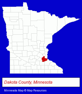
The Minnesota counties map at upper right shows Dakota County, highlighted in red. Use the menu below to display interactive maps of Inver Grove Heights, either in a frame on this page or in full-screen mode.
Use the menu below to display categorized Inver Grove Heights directories.
| Inver Grove Heights Directory Page: | Banks |
|---|
Selected Inver Grove Heights, Minnesota Listings
These Inver Grove Heights listings provide some insight into the city's cultural environment and economic climate.- Outdoor Sports & Recreation
- Public Golf Courses
- Golf
- Golf Courses
- Private Golf Courses
- Musical Instruments Retail
- Musical Instrument Service & Repair
- Guitars
- Clinics & Medical Centers
- Clinics
- Cosmetic Dentists
- Accountants
- Public Accountants
- Accounting, Auditing & Bookkeeping Services
- Tax Return Preparation
- Tax Return Preparation & Electronic Filing
- Moving & Storage
- Household Goods & Furniture Storage
- Home Improvement & Maintenance
- Building Materials & Supplies Dealers
- Home Furnishings Stores
- Furniture Stores
- Marinas
- Attorneys
- Corporate Business Attorneys
- Personal Injury Attorneys
- Insurance Law Attorneys
Nearby Minnesota Cities and Towns *
- Apple Valley (1) - Apple Valley, Minnesota information and maps.
- Burnsville (14) - Burnsville, Minnesota demographics and directory.
- Hastings (3) - Hastings, Minnesota information and maps.
- Lakeville (9) - Lakeville, Minnesota demographics and directory.
- Minneapolis (150) - Minneapolis, Minnesota products & services directory.
- Saint Paul (85) - Saint Paul, Minnesota products & services directory.
Large and Mid-size Cities in Nearby States
- Hudson, Wisconsin (10) - Hudson, WI demographics and maps.
* Parenthesized numbers indicate economic activity levels.
Copyright © 2011-2026 RegionalDirectory.us. All rights reserved.