Moorhead, Minnesota Map and Directory
Regional Directory > States Menu > Minnesota
 According to the United States Census Bureau, Moorhead is a City that is located in Clay County, Minnesota at 46.87 degrees North and 96.77 degrees West.
The city's time zone is America/Chicago, and the city's primary telephone area code is 218.
The land area of Moorhead is about 22.32 square miles, whereas the water area of the city is about 0.00 square miles.
Clay County's land area is about 1,045 square miles, so the city occupies about 2.1 percent of the county's total land area.
According to the United States Census Bureau, Moorhead is a City that is located in Clay County, Minnesota at 46.87 degrees North and 96.77 degrees West.
The city's time zone is America/Chicago, and the city's primary telephone area code is 218.
The land area of Moorhead is about 22.32 square miles, whereas the water area of the city is about 0.00 square miles.
Clay County's land area is about 1,045 square miles, so the city occupies about 2.1 percent of the county's total land area.
The Census Bureau estimates that Moorhead had about 43,652 residents in 2019, which is approximately 1,956 people per square mile of land area.
According to recent American Community Survey data, the median household income in Moorhead was about $60,315 per year.
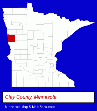
The Minnesota counties map at upper right shows Clay County, highlighted in red. Use the menu below to display interactive maps of Moorhead, either in a frame on this page or in full-screen mode.
Use the menu below to display categorized Moorhead directories.
| Moorhead Products and Services Directory | |
|---|---|
| Building Materials | Home Improvement |
Selected Moorhead, Minnesota Listings
These representative Moorhead listings provide some insight into the city's cultural environment and economic climate.- Schools
- Colleges & Universities
- Financial Services
- Accounting, Auditing & Bookkeeping Services
- Lodging
- Hotels
- Motels
- Information Technology Services
- Computer Software
- Computer & Equipment Dealers
- Computer & Software Stores
- Auto Service & Repair
- Auto Body Repair & Painting
- Attorneys
- Attorneys
- Fence Dealers
- Fence Materials
- Building & Home Construction
- Architects
- Architectural Services
- Antiques
- Antique Dealers
- Shopping Centers & Malls
- Physicians & Surgeons
- Alternative Medicine
- Chiropractors
- Alternative Medicine Practitioners
- Industrial Equipment & Supplies Dealers
- Industrial Equipment & Supplies Wholesale & Manufacturers
- Building Materials & Supplies Wholesale & Manufacturers
- Construction Machinery & Equipment Wholesale & Manufacturers
- Alternative Medicine
- Alternative Medicine Practitioners
- Beauty & Day Spas
- Certified & Registered Massage Therapists
- Manicures & Pedicures
- Metals
- Agricultural Equipment & Supplies Retail
- Farm Equipment & Supplies Dealers
- Farm Equipment & Parts Wholesale & Manufacturers
- Grain & Feed Handling Equipment
Nearby Minnesota Cities and Towns *
- Bemidji (8) - Bemidji, Minnesota demographics and maps.
- East Grand Forks (1) - East Grand Forks, Minnesota information and maps.
- Fergus Falls (3) - Fergus Falls, Minnesota information and maps.
Large and Mid-size Cities in Nearby States
- Fargo, North Dakota (36) - Fargo, ND solutions directory and maps.
* Parenthesized numbers indicate economic activity levels.
Copyright © 2011-2026 RegionalDirectory.us. All rights reserved.