Park Rapids, Minnesota Map and Directory
Regional Directory > States Menu > Minnesota
 According to the United States Census Bureau, Park Rapids is a City that is located in Hubbard County, Minnesota at 46.92 degrees North and 95.06 degrees West.
The city's time zone is America/Chicago, and the city's primary telephone area code is 218.
The land area of Park Rapids is about 6.84 square miles, whereas the water area of the city is about 0.29 square miles.
Hubbard County's land area is about 926 square miles, so the city occupies about 0.7 percent of the county's total land area.
According to the United States Census Bureau, Park Rapids is a City that is located in Hubbard County, Minnesota at 46.92 degrees North and 95.06 degrees West.
The city's time zone is America/Chicago, and the city's primary telephone area code is 218.
The land area of Park Rapids is about 6.84 square miles, whereas the water area of the city is about 0.29 square miles.
Hubbard County's land area is about 926 square miles, so the city occupies about 0.7 percent of the county's total land area.
The Census Bureau estimates that Park Rapids had about 3,927 residents in 2014, which is approximately 574 people per square mile of land area.
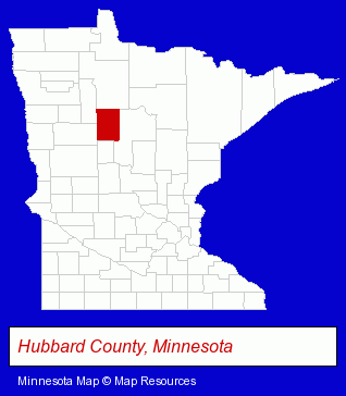
The Minnesota counties map at upper right shows Hubbard County, highlighted in red. Use the menu below to display interactive maps of Park Rapids, either in a frame on this page or in full-screen mode.
Use the menu below to display categorized Park Rapids directories.
| Park Rapids Products and Services Directory | |
|---|---|
| Home Improvement | Printing and Publishing |
Selected Park Rapids, Minnesota Listings
These representative Park Rapids listings provide some insight into the city's cultural environment and economic climate.- Home Furnishings Stores
- Furniture Stores
- Laundries
- Self Service Laundries
- Sporting Goods Dealers
- Title Insurance
- Real Estate Title Search & Abstract Services
- Publishing Consultants & Services
- Auto Service & Repair
- Auto Parts Retail
- Auto Glass Retail
- Auto Glass Replacement & Repair
- Dentists
- Orthodontics Dentists
- Radio Sales & Service
- Aircraft Painting, Service & Repair
- Aircraft Modification & Overhaul
- Aircraft Cleaning
- Printing Services
- Commercial Printing
- Publishers
- Newspaper Publishers
- Clinics & Medical Centers
- Rehabilitation Services
- Hospitals
- Physical Therapists
- Physical Therapy
Nearby Minnesota Cities and Towns *
- Alexandria (4) - Alexandria, Minnesota information and maps.
- Bemidji (8) - Bemidji, Minnesota demographics and maps.
- Brainerd (6) - Brainerd, Minnesota demographics and maps.
- Crosslake (1) - Crosslake, Minnesota information and maps.
- Pequot Lakes (1) - Pequot Lakes, Minnesota information and maps.
Large and Mid-size Cities in Nearby States
- Fargo, North Dakota (36) - Fargo, ND solutions directory and maps.
* Parenthesized numbers indicate economic activity levels.
Copyright © 2011-2026 RegionalDirectory.us. All rights reserved.