Red Wing, Minnesota Map and Directory
Regional Directory > States Menu > Minnesota
 According to the United States Census Bureau, Red Wing is a City that is located in Goodhue County, Minnesota at 44.56 degrees North and 92.53 degrees West.
The city's time zone is America/Chicago, and the city's primary telephone area code is 651.
The land area of Red Wing is about 34.60 square miles, whereas the water area of the city is about 6.59 square miles.
Goodhue County's land area is about 757 square miles, so the city occupies about 4.6 percent of the county's total land area.
According to the United States Census Bureau, Red Wing is a City that is located in Goodhue County, Minnesota at 44.56 degrees North and 92.53 degrees West.
The city's time zone is America/Chicago, and the city's primary telephone area code is 651.
The land area of Red Wing is about 34.60 square miles, whereas the water area of the city is about 6.59 square miles.
Goodhue County's land area is about 757 square miles, so the city occupies about 4.6 percent of the county's total land area.
The Census Bureau estimates that Red Wing had about 16,320 residents in 2019, which is approximately 472 people per square mile of land area.
According to recent American Community Survey data, the median household income in Red Wing was about $54,785 per year.
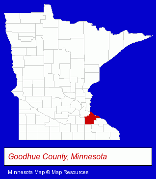
The Minnesota counties map at upper right shows Goodhue County, highlighted in red. Use the menu below to display interactive maps of Red Wing, either in a frame on this page or in full-screen mode.
Use the menu below to display categorized Red Wing directories.
| Red Wing Directory Page: | Home Improvement |
|---|
Selected Red Wing, Minnesota Listings
These Red Wing listings provide some insight into the city's cultural environment and economic climate.- Cultural Attractions, Events & Facilities
- Libraries
- Event Planning
- Conventions, Conferences & Trade Shows
- Convention & Meeting Facilities & Services
- Convention & Meeting Planners
- Boat Dealers
- Motorcycle, Motor Scooter & Minibike Dealers
- Marine Equipment & Supplies Retail
- Used Motorcycles & Motor Scooters
- Snowmobile Dealers
- Financial Services
- Mortgages
- Real Estate Loans
- Personal Loans
- Plumbing Equipment Rental
- Clothing Stores
- Clothing & Accessories Retail
- Clothing Stores
- Clothing & Accessories Retail
Nearby Minnesota Cities and Towns *
- Hastings (3) - Hastings, Minnesota information and maps.
- Inver Grove Heights (1) - Inver Grove Heights, Minnesota information and maps.
- Lakeville (9) - Lakeville, Minnesota demographics and directory.
- Northfield (3) - Northfield, Minnesota information and maps.
- Rochester (19) - Rochester, Minnesota solutions directory and maps.
- Saint Paul (85) - Saint Paul, Minnesota products & services directory.
- Stillwater (5) - Stillwater, Minnesota demographics and maps.
* Parenthesized numbers indicate economic activity levels.
Copyright © 2011-2026 RegionalDirectory.us. All rights reserved.