Independence, Missouri Map and Directory
Regional Directory > States Menu > Missouri
 According to the United States Census Bureau, Independence is a City that is located primarily in Jackson County, Missouri at 39.09 degrees North and 94.35 degrees West.
The city's time zone is America/Chicago, and the city's primary telephone area code is 816.
The land area of Independence is about 77.81 square miles, whereas the water area of the city is about 0.45 square miles.
According to the United States Census Bureau, Independence is a City that is located primarily in Jackson County, Missouri at 39.09 degrees North and 94.35 degrees West.
The city's time zone is America/Chicago, and the city's primary telephone area code is 816.
The land area of Independence is about 77.81 square miles, whereas the water area of the city is about 0.45 square miles.
The Census Bureau estimates that Independence had about 116,672 residents in 2019, which is approximately 1,499 people per square mile of land area.
According to recent American Community Survey data, the median household income in Independence was about $50,592 per year.
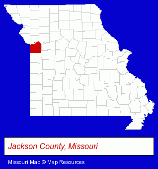
The Missouri counties map at upper right shows Jackson County, highlighted in red. Use the menu below to display interactive maps of Independence, either in a frame on this page or in full-screen mode.
Use the menu below to display categorized Independence directories.
| Independence Products and Services Directory | ||
|---|---|---|
| Attorneys | Auto Service | Chiropractic Clinics |
| Chiropractors | Clinics | Clothing Stores |
| Dentists | Insurance | Metal Finishing |
| Metals | Physicians | Printing and Publishing |
| Recreation Centers | Restaurants | Schools |
| Visual Arts | ||
Selected Independence, Missouri Listings
These randomly selected Independence listings in 64057 provide a window into the city's cultural environment and economic climate. All Points Travel Inc- Airline Tickets
- Airlines
- Medical Equipment & Supplies Retail
- Hospital Supplies
- Credit Unions
- Rehabilitation Services
- General Practice
- Orthopedics Physicians & Surgeons
- Veterinarians
- Animal Hospitals
- Pet Sitting & Day Care
- Pet Grooming
- Charitable & Nonprofit Organizations
- Colleges & Universities
- Laboratories
- Research & Development Laboratories
- Electronic Equipment & Supplies Wholesale & Manufacturers
- Electric Equipment & Supplies Dealers
- Electronic Equipment & Supplies Wholesale & Manufacturers
- Rehabilitation Services
- Osteopathic Physicians & Surgeons
- General Practice
- Sports Medicine Physicians & Surgeons
- Boarding Stables
- Equestrian Sports & Recreation
- Horseback Riding
- Building & Home Construction
- Special Trades Contractors
- Masonry Contractors
- Retirement Housing
- Nursing & Convalescent Homes
- Retirement Communities & Homes
- Retirement Planning Consultants & Services
- Travel Agents
- Cruise Lines & Agents
Nearby Missouri Cities and Towns *
- Blue Springs (8) - Blue Springs, Missouri demographics and maps.
- Grain Valley (1) - Grain Valley, Missouri information and maps.
- Kansas City (115) - Kansas City, Missouri products & services directory.
- Lees Summit (18) - Lees Summit, Missouri solutions directory and maps.
- Raytown (1) - Raytown, Missouri information and maps.
Large and Mid-size Cities in Nearby States
- Leawood, Kansas (19) - Leawood, KS demographics and directory.
- Kansas City, Kansas (16) - Kansas City, KS demographics and directory.
* Parenthesized numbers indicate economic activity levels.
Copyright © 2011-2026 RegionalDirectory.us. All rights reserved.