Columbus, Mississippi Map and Directory
Regional Directory > States Menu > Mississippi
 According to the United States Census Bureau, Columbus is a City that is located in Lowndes County, Mississippi at 33.50 degrees North and 88.43 degrees West.
The city's time zone is America/Chicago, and the city's primary telephone area code is 662.
The land area of Columbus is about 22.09 square miles, whereas the water area of the city is about 0.76 square miles.
Lowndes County's land area is about 506 square miles, so the city occupies about 4.4 percent of the county's total land area.
According to the United States Census Bureau, Columbus is a City that is located in Lowndes County, Mississippi at 33.50 degrees North and 88.43 degrees West.
The city's time zone is America/Chicago, and the city's primary telephone area code is 662.
The land area of Columbus is about 22.09 square miles, whereas the water area of the city is about 0.76 square miles.
Lowndes County's land area is about 506 square miles, so the city occupies about 4.4 percent of the county's total land area.
The Census Bureau estimates that Columbus had about 23,573 residents in 2019, which is approximately 1,067 people per square mile of land area.
According to recent American Community Survey data, the median household income in Columbus was about $36,336 per year.
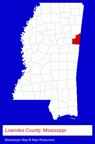
The Mississippi counties map at upper right shows Lowndes County, highlighted in red. Use the menu below to display interactive maps of Columbus, either in a frame on this page or in full-screen mode.
Use the menu below to display categorized Columbus directories.
| Columbus Products and Services Directory | ||
|---|---|---|
| Building Materials | Home Improvement | Insurance |
Selected Columbus, Mississippi Listings
These representative Columbus listings provide some insight into the city's cultural environment and economic climate.- Vocational Education
- Aircraft Painting, Service & Repair
- Aviation Schools
- Industrial Equipment & Supplies Wholesale & Manufacturers
- Electric & Electronic Equipment & Supplies
- Electric Motor Dealers
- Electric Motors & Generators Wholesale & Manufacturers
- Auto Parts Retail
- Auto Parts Wholesale & Manufacturers
- Used & Rebuilt Auto Parts Retail
- Used & Rebuilt Auto Parts Wholesale & Manufacturers
- Restaurants
- Steak Restaurants
- Importers
- Agricultural Equipment & Supplies Retail
- Farm Equipment & Supplies Dealers
- Construction Machinery & Equipment Wholesale & Manufacturers
- Farm Equipment & Parts Wholesale & Manufacturers
- Schools
- Colleges & Universities
- Vocational Education
- Event Planning
- Computer Technology Schools
- Farm Equipment & Parts Wholesale & Manufacturers
Nearby Mississippi Cities and Towns *
- Jackson (19) - Jackson, Mississippi solutions directory and maps.
- Meridian (3) - Meridian, Mississippi information and maps.
- Mississippi State (1) - Mississippi State, Mississippi information and maps.
- Oxford (5) - Oxford, Mississippi demographics and maps.
- Tupelo (5) - Tupelo, Mississippi demographics and maps.
* Parenthesized numbers indicate economic activity levels.
Copyright © 2011-2026 RegionalDirectory.us. All rights reserved.