Butte, Montana Map and Directory
Regional Directory > States Menu > Montana
 According to the United States Census Bureau, Butte is classified as an "Other" type of place that is located in Silver Bow County, Montana at 45.90 degrees North and 112.66 degrees West.
The place's time zone is America/Denver, and the place's primary telephone area code is 406.
The land area of Butte is about 717.99 square miles, whereas the water area of the place is about 0.59 square miles.
Silver Bow County's land area is about 718 square miles, so the place occupies about 100.0 percent of the county's total land area.
According to the United States Census Bureau, Butte is classified as an "Other" type of place that is located in Silver Bow County, Montana at 45.90 degrees North and 112.66 degrees West.
The place's time zone is America/Denver, and the place's primary telephone area code is 406.
The land area of Butte is about 717.99 square miles, whereas the water area of the place is about 0.59 square miles.
Silver Bow County's land area is about 718 square miles, so the place occupies about 100.0 percent of the county's total land area.
The Census Bureau estimates that Butte had about 34,207 residents in 2019, which is approximately 48 people per square mile of land area.
According to recent American Community Survey data, the median household income in Butte was about $45,797 per year.
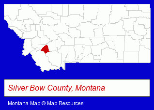
The Montana counties map at upper right shows Silver Bow County, highlighted in red. Use the menu below to display interactive maps of Butte, either in a frame on this page or in full-screen mode.
Use the menu below to display categorized Butte directories.
| Butte Directory Page: | Banks |
|---|
Selected Butte, Montana Listings
These Butte listings provide some insight into the place's cultural environment and economic climate.- Building & Home Construction
- Builders & Contractors
- Foundation Contractors
- Financial Institutions
- Credit Unions
- Personal Loans
- Mortgage & Loan Banks
- Gift Shops
- Souvenir & Novelty Shops
- Cultural Attractions, Events & Facilities
- Tourist Information & Attractions
- Museums
- Accountants
- Certified Public Accountants
- Restaurants
- Steak Restaurants
- Fast Food Restaurants
- Sandwich Shops
- Lodging
- Hotels
- Bed & Breakfast Reservations
- Hotel & Motel Reservations
Nearby Montana Cities and Towns *
- Belgrade (1) - Belgrade, Montana information and maps.
- Billings (28) - Billings, Montana solutions directory and maps.
- Bozeman (25) - Bozeman, Montana solutions directory and maps.
- Hamilton (3) - Hamilton, Montana information and maps.
- Helena (13) - Helena, Montana demographics and directory.
- Kalispell (13) - Kalispell, Montana demographics and directory.
- Missoula (22) - Missoula, Montana solutions directory and maps.
* Parenthesized numbers indicate economic activity levels.
Copyright © 2011-2026 RegionalDirectory.us. All rights reserved.