Missoula, Montana Map and Directory
Regional Directory > States Menu > Montana
 According to the United States Census Bureau, Missoula is a City that is located in Missoula County, Montana at 46.87 degrees North and 113.99 degrees West.
The city's time zone is America/Denver, and the city's primary telephone area code is 406.
The land area of Missoula is about 28.90 square miles, whereas the water area of the city is about 0.18 square miles.
Missoula County's land area is about 2,593 square miles, so the city occupies about 1.1 percent of the county's total land area.
According to the United States Census Bureau, Missoula is a City that is located in Missoula County, Montana at 46.87 degrees North and 113.99 degrees West.
The city's time zone is America/Denver, and the city's primary telephone area code is 406.
The land area of Missoula is about 28.90 square miles, whereas the water area of the city is about 0.18 square miles.
Missoula County's land area is about 2,593 square miles, so the city occupies about 1.1 percent of the county's total land area.
The Census Bureau estimates that Missoula had about 75,516 residents in 2019, which is approximately 2,613 people per square mile of land area.
According to recent American Community Survey data, the median household income in Missoula was about $47,426 per year. This Missoula Real Estate directory lists real estate solution providers in Missoula, Montana.
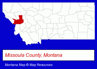
The Montana counties map at upper right shows Missoula County, highlighted in red. Use the menu below to display interactive maps of Missoula, either in a frame on this page or in full-screen mode.
Use the menu below to display categorized Missoula directories.
Selected Missoula, Montana Listings
These randomly selected Missoula listings provide some insight into the city's cultural environment and economic climate.- Internet Products & Services
- Computers & Equipment Repair & Maintenance
- Web Site Design
- Web Sites
- Ice Cream & Frozen Yogurt Shops
- Ice Cream
- Ice Cream Cones Retail
- Alternative Medicine
- Chiropractors
- Alternative Medicine Practitioners
- Clinics
- Family & General Practice Physicians & Surgeons
- Moving & Storage
- Trucking Companies
- Moving & Storage Commercial & Industrial
- Heavy Duty Trucking
- Heavy Equipment Movers
- Business Consultants & Advisors
- Management Consultants
- Business Management Services
- Fruit & Vegetable Growers, Shippers & Packers
- Cosmetic Dentists
- Tours & Charters
- Fishing Equipment & Supplies Dealers
- Fishing Bait & Tackle
- Fishing Guides & Charters
- Metal Fabricators
- Sheet Metal Equipment & Supplies Wholesale & Manufacturers
- Air Transportation
- Radio Sales & Service
- Aircraft Painting, Service & Repair
- Aircraft Charter, Rental & Leasing
- Aircraft Modification & Overhaul
- Personal Injury Attorneys
- Criminal Law Attorneys
- Malpractice & Negligence Attorneys
Nearby Montana Cities and Towns *
- Bigfork (1) - Bigfork, Montana information and maps.
- Bozeman (25) - Bozeman, Montana solutions directory and maps.
- Butte (1) - Butte, Montana information and maps.
- Hamilton (3) - Hamilton, Montana information and maps.
- Helena (13) - Helena, Montana demographics and directory.
- Kalispell (13) - Kalispell, Montana demographics and directory.
- Whitefish (1) - Whitefish, Montana information and maps.
* Parenthesized numbers indicate economic activity levels.
Copyright © 2011-2026 RegionalDirectory.us. All rights reserved.