Helena, Montana Map and Directory
Regional Directory > States Menu > Montana
 According to the United States Census Bureau, Helena is a City that is located in Lewis and Clark County, Montana at 46.59 degrees North and 112.04 degrees West.
The city's time zone is America/Denver, and the city's primary telephone area code is 406.
The land area of Helena is about 16.50 square miles, whereas the water area of the city is about 0.04 square miles.
Lewis and Clark County's land area is about 3,459 square miles, so the city occupies about 0.5 percent of the county's total land area.
According to the United States Census Bureau, Helena is a City that is located in Lewis and Clark County, Montana at 46.59 degrees North and 112.04 degrees West.
The city's time zone is America/Denver, and the city's primary telephone area code is 406.
The land area of Helena is about 16.50 square miles, whereas the water area of the city is about 0.04 square miles.
Lewis and Clark County's land area is about 3,459 square miles, so the city occupies about 0.5 percent of the county's total land area.
The Census Bureau estimates that Helena had about 33,124 residents in 2019, which is approximately 2,008 people per square mile of land area.
According to recent American Community Survey data, the median household income in Helena was about $61,324 per year. This Helena Real Estate directory lists real estate solution providers in Helena, Montana.
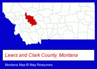
The Montana counties map at upper right shows Lewis and Clark County, highlighted in red. Use the menu below to display interactive maps of Helena, either in a frame on this page or in full-screen mode.
Use the menu below to display categorized Helena directories.
| Helena Products and Services Directory | ||
|---|---|---|
| Attorneys | Auto Service | Clinics |
| Environmental Services | Financial Services | Grocery Stores |
| Home Improvement | Information Technology | Moving and Storage |
| Restaurants | Schools | Title Insurance |
| Visual Arts | ||
Selected Helena, Montana Listings
These randomly selected Helena listings provide some insight into the city's cultural environment and economic climate.- Printing & Publishing
- Printing Services
- Commercial Printing
- Commercial & Graphic Artists
- Mail Services & Package Shipping
- Home Furnishings Stores
- Housewares Stores
- Sewing Machine Dealers
- Quilting Materials & Supplies Retail
- Metal Finishing
- Air Transportation
- Aircraft Painting, Service & Repair
- Aircraft Charter, Rental & Leasing
- Truck Dealers
- Auto Parts Wholesale & Manufacturers
- Used & Rebuilt Auto Parts Retail
- Used & Rebuilt Auto Parts Wholesale & Manufacturers
- Wrecker Dealers
- Chambers of Commerce
- Dentists
- Orthodontics Dentists
- Personal Loans
- Personal Financial Services
- Loan & Financing Services
- Personal Financing
- Meats Retail
- Optical Goods Retail
- Printing & Publishing
- Publishers
- Book Publishers
- Elementary & Secondary Education
- Elementary Schools
- Private Schools
- Religious Education Schools
- Homes & Residential Real Estate
- General Real Estate
- Real Estate Commercial & Industrial
- Real Estate Investments
Nearby Montana Cities and Towns *
- Belgrade (1) - Belgrade, Montana information and maps.
- Bozeman (25) - Bozeman, Montana solutions directory and maps.
- Butte (1) - Butte, Montana information and maps.
- Great Falls (4) - Great Falls, Montana information and maps.
- Kalispell (13) - Kalispell, Montana demographics and directory.
- Livingston (1) - Livingston, Montana information and maps.
- Missoula (22) - Missoula, Montana solutions directory and maps.
* Parenthesized numbers indicate economic activity levels.
Copyright © 2011-2026 RegionalDirectory.us. All rights reserved.