Blowing Rock, North Carolina Map and Directory
Regional Directory > States Menu > North Carolina
 According to the United States Census Bureau, Blowing Rock is a Town that is located primarily in Watauga County, North Carolina at 36.13 degrees North and 81.67 degrees West.
The town's time zone is America/New York, and the town's primary telephone area code is 828.
The land area of Blowing Rock is about 3.00 square miles, whereas the water area of the town is about 0.05 square miles.
According to the United States Census Bureau, Blowing Rock is a Town that is located primarily in Watauga County, North Carolina at 36.13 degrees North and 81.67 degrees West.
The town's time zone is America/New York, and the town's primary telephone area code is 828.
The land area of Blowing Rock is about 3.00 square miles, whereas the water area of the town is about 0.05 square miles.
The Census Bureau estimates that Blowing Rock had about 1,233 residents in 2014, which is approximately 411 people per square mile of land area.
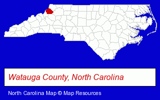
The North Carolina counties map at upper right shows Watauga County, highlighted in red. Use the menu below to display interactive maps of Blowing Rock, either in a frame on this page or in full-screen mode.
Use the menu below to display categorized Blowing Rock directories.
| Blowing Rock Products and Services Directory | ||
|---|---|---|
| Hotels | Restaurants | Vacation Home Rental |
Selected Blowing Rock, North Carolina Listings
These representative Blowing Rock listings in 28605 provide a window into the town's cultural environment and economic climate. 444 Inc- Builders & Contractors
- Building Contractors
- Lodging
- Hotels
- Motels
- American Restaurants
- Bar & Grill Restaurants
- French Restaurants
- Home Furnishings Stores
- Furniture Stores
- Inns
- Toy Stores
- School Supplies & Equipment Retail
- Gift Shops
Nearby North Carolina Cities and Towns *
- Banner Elk (4) - Banner Elk, North Carolina information and maps.
- Boone (9) - Boone, North Carolina demographics and directory.
- Granite Falls (1) - Granite Falls, North Carolina information and maps.
- Hickory (27) - Hickory, North Carolina solutions directory and maps.
- Lenoir (1) - Lenoir, North Carolina information and maps.
- Morganton (4) - Morganton, North Carolina information and maps.
- Statesville (10) - Statesville, North Carolina demographics and directory.
* Parenthesized numbers indicate economic activity levels.
Copyright © 2011-2026 RegionalDirectory.us. All rights reserved.