Lenoir, North Carolina Map and Directory
Regional Directory > States Menu > North Carolina
 According to the United States Census Bureau, Lenoir is a City that is located in Caldwell County, North Carolina at 35.91 degrees North and 81.54 degrees West.
The city's time zone is America/New York, and the city's primary telephone area code is 828.
The land area of Lenoir is about 19.73 square miles, whereas the water area of the city is about 0.00 square miles.
Caldwell County's land area is about 472 square miles, so the city occupies about 4.2 percent of the county's total land area.
According to the United States Census Bureau, Lenoir is a City that is located in Caldwell County, North Carolina at 35.91 degrees North and 81.54 degrees West.
The city's time zone is America/New York, and the city's primary telephone area code is 828.
The land area of Lenoir is about 19.73 square miles, whereas the water area of the city is about 0.00 square miles.
Caldwell County's land area is about 472 square miles, so the city occupies about 4.2 percent of the county's total land area.
The Census Bureau estimates that Lenoir had about 17,913 residents in 2019, which is approximately 908 people per square mile of land area.
According to recent American Community Survey data, the median household income in Lenoir was about $36,755 per year.
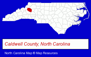
The North Carolina counties map at upper right shows Caldwell County, highlighted in red. Use the menu below to display interactive maps of Lenoir, either in a frame on this page or in full-screen mode.
Use the menu below to display categorized Lenoir directories.
| Lenoir Directory Page: | Home Improvement |
|---|
Selected Lenoir, North Carolina Listings
These Lenoir listings provide some insight into the city's cultural environment and economic climate.- Financial Services
- Clinics & Medical Centers
- Charitable & Nonprofit Organizations
- Home Health Care
- Hospice Services
- Industrial Equipment & Supplies Dealers
- Metals
- Industrial Equipment & Supplies Wholesale & Manufacturers
- Sheet Metal Work
- Truck Dealers
- Used Cars
- Used Trucks
- Schools
- Government Contractors
- Furniture Wholesale & Manufacturers
- Floors & Flooring Contractors
- Floors & Flooring Installation
- Floors & Flooring Retail
- Floor Resurfacing Materials
- Dentists
- Maxillofacial Physicians & Surgeons
- Pottery Retail
- Banks
- Building & Home Construction
- Builders & Contractors
- Metal Buildings Dealers
- Metal Building Contractors
Nearby North Carolina Cities and Towns *
- Blowing Rock (3) - Blowing Rock, North Carolina information and maps.
- Boone (9) - Boone, North Carolina demographics and directory.
- Conover (3) - Conover, North Carolina information and maps.
- Granite Falls (1) - Granite Falls, North Carolina information and maps.
- Hickory (27) - Hickory, North Carolina solutions directory and maps.
- Morganton (4) - Morganton, North Carolina information and maps.
- Statesville (10) - Statesville, North Carolina demographics and directory.
* Parenthesized numbers indicate economic activity levels.
Copyright © 2011-2026 RegionalDirectory.us. All rights reserved.