Statesville, North Carolina Map and Directory
Regional Directory > States Menu > North Carolina
 According to the United States Census Bureau, Statesville is a City that is located in Iredell County, North Carolina at 35.78 degrees North and 80.89 degrees West.
The city's time zone is America/New York, and the city's primary telephone area code is 704.
The land area of Statesville is about 24.10 square miles, whereas the water area of the city is about 0.11 square miles.
Iredell County's land area is about 574 square miles, so the city occupies about 4.2 percent of the county's total land area.
According to the United States Census Bureau, Statesville is a City that is located in Iredell County, North Carolina at 35.78 degrees North and 80.89 degrees West.
The city's time zone is America/New York, and the city's primary telephone area code is 704.
The land area of Statesville is about 24.10 square miles, whereas the water area of the city is about 0.11 square miles.
Iredell County's land area is about 574 square miles, so the city occupies about 4.2 percent of the county's total land area.
The Census Bureau estimates that Statesville had about 27,528 residents in 2019, which is approximately 1,142 people per square mile of land area.
According to recent American Community Survey data, the median household income in Statesville was about $39,987 per year.
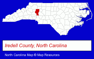
The North Carolina counties map at upper right shows Iredell County, highlighted in red. Use the menu below to display interactive maps of Statesville, either in a frame on this page or in full-screen mode.
Use the menu below to display categorized Statesville directories.
| Statesville Products and Services Directory | ||
|---|---|---|
| Attorneys | Auto Insurance | Auto Service |
| Building Materials | Clinics | Dentists |
| Home Improvement | Insurance | Physicians |
| Visual Arts | ||
Selected Statesville, North Carolina Listings
These randomly selected Statesville listings provide some insight into the city's cultural environment and economic climate.- Florists
- Gift Baskets & Packs Retail
- Fruit Baskets
- Roofing Contractors
- Metal Fabricators
- Metal Buildings Dealers
- Roofing Materials Wholesale & Manufacturers
- Roofing Material Dealers
- Carpet & Rug Dealers
- Floor Resurfacing Materials
- Packaging & Shipping Materials Retail
- Plastic Fabrics, Film, Sheets & Rods Manufacturers
- Movers
- Household Goods Moving & Storage
- Commodity & Merchandise Warehouses
- Pedodontics Dentists
- Pediatrics Dentists
- Hospitals
- Building Materials & Supplies Wholesale & Manufacturers
- Hotels
- Bed & Breakfasts
- Recycling Centers
- Scrap Iron & Metals
- Metal Refiners & Smelters
- Orthodontics Dentists
- Arbitration & Mediation Services
- Arbitration & Mediation Services Attorneys
- Arbitrators
- Funeral Services
- Funeral Homes & Directors
- Cemeteries & Memorial Parks
- Cemeteries & Crematories
- Cremation Services
- Computer & Equipment Dealers
- Electronic Equipment & Supplies Wholesale & Manufacturers
- Computers & Equipment Wholesale & Manufacturers
- Importers
- Agricultural Equipment & Supplies Retail
- Farm Equipment & Supplies Dealers
- Marine Equipment & Supplies Retail
Nearby North Carolina Cities and Towns *
- Conover (3) - Conover, North Carolina information and maps.
- Cornelius (10) - Cornelius, North Carolina demographics and directory.
- Denver (5) - Denver, North Carolina demographics and maps.
- Hickory (27) - Hickory, North Carolina solutions directory and maps.
- Huntersville (11) - Huntersville, North Carolina demographics and directory.
- Mooresville (14) - Mooresville, North Carolina demographics and directory.
- Salisbury (12) - Salisbury, North Carolina demographics and directory.
* Parenthesized numbers indicate economic activity levels.
Copyright © 2011-2026 RegionalDirectory.us. All rights reserved.