Waxhaw, North Carolina Map and Directory
Regional Directory > States Menu > North Carolina
 According to the United States Census Bureau, Waxhaw is a Town that is located in Union County, North Carolina at 34.92 degrees North and 80.74 degrees West.
The town's time zone is America/New York, and the town's primary telephone area code is 704.
The land area of Waxhaw is about 11.71 square miles, whereas the water area of the town is about 0.10 square miles.
Union County's land area is about 632 square miles, so the town occupies about 1.9 percent of the county's total land area.
According to the United States Census Bureau, Waxhaw is a Town that is located in Union County, North Carolina at 34.92 degrees North and 80.74 degrees West.
The town's time zone is America/New York, and the town's primary telephone area code is 704.
The land area of Waxhaw is about 11.71 square miles, whereas the water area of the town is about 0.10 square miles.
Union County's land area is about 632 square miles, so the town occupies about 1.9 percent of the county's total land area.
The Census Bureau estimates that Waxhaw had about 17,147 residents in 2019, which is approximately 1,464 people per square mile of land area.
According to recent American Community Survey data, the median household income in Waxhaw was about $111,642 per year.
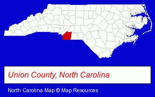
The North Carolina counties map at upper right shows Union County, highlighted in red. Use the menu below to display interactive maps of Waxhaw, either in a frame on this page or in full-screen mode.
Use the menu below to display categorized Waxhaw directories.
| Waxhaw Directory Page: | Schools |
|---|
Selected Waxhaw, North Carolina Listings
These Waxhaw listings provide some insight into the town's cultural environment and economic climate.- Metals
- Metal Products
- Metal Products Wholesale & Manufacturers
- Watches Retail
- Kennels
- Pet Sitting & Day Care
- Government Contractors
- Air Transportation
- Airlines
- Dentists
- Dentists
- Discount Stores
- Land Surveyors
- Pet Care Services
- Pet Grooming & Boarding
- Pet Grooming
- Auto Body Repair & Painting
- Collision Services
Nearby North Carolina Cities and Towns *
- Charlotte (173) - Charlotte, North Carolina products & services directory.
- Gastonia (16) - Gastonia, North Carolina demographics and directory.
- Huntersville (11) - Huntersville, North Carolina demographics and directory.
- Indian Trail (2) - Indian Trail, North Carolina information and maps.
- Matthews (14) - Matthews, North Carolina demographics and directory.
- Monroe (9) - Monroe, North Carolina demographics and directory.
- Pineville (3) - Pineville, North Carolina information and maps.
Large and Mid-size Cities in Nearby States
- Rock Hill, South Carolina (7) - Rock Hill, SC demographics and maps.
* Parenthesized numbers indicate economic activity levels.
Copyright © 2011-2026 RegionalDirectory.us. All rights reserved.