Rochester, New Hampshire Map and Directory
Regional Directory > States Menu > New Hampshire
 According to the United States Census Bureau, Rochester is a City that is located in Strafford County, New Hampshire at 43.30 degrees North and 70.98 degrees West.
The city's time zone is America/New York, and the city's primary telephone area code is 603.
The land area of Rochester is about 45.40 square miles, whereas the water area of the city is about 0.36 square miles.
Strafford County's land area is about 369 square miles, so the city occupies about 12.3 percent of the county's total land area.
According to the United States Census Bureau, Rochester is a City that is located in Strafford County, New Hampshire at 43.30 degrees North and 70.98 degrees West.
The city's time zone is America/New York, and the city's primary telephone area code is 603.
The land area of Rochester is about 45.40 square miles, whereas the water area of the city is about 0.36 square miles.
Strafford County's land area is about 369 square miles, so the city occupies about 12.3 percent of the county's total land area.
The Census Bureau estimates that Rochester had about 31,526 residents in 2019, which is approximately 694 people per square mile of land area.
According to recent American Community Survey data, the median household income in Rochester was about $62,179 per year.
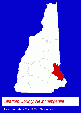
The New Hampshire counties map at upper right shows Strafford County, highlighted in red. Use the menu below to display interactive maps of Rochester, either in a frame on this page or in full-screen mode.
Use the menu below to display categorized Rochester directories.
| Rochester Directory Page: | Restaurants |
|---|
Selected Rochester, New Hampshire Listings
These Rochester listings provide some insight into the city's cultural environment and economic climate.- Auto Parts Retail
- Auto Accessories Retail
- Veterinarians
- Animal Hospitals
- Animal Health
- Take Out
- Chinese Restaurants
- Painting Contractors
- Industrial Equipment & Supplies Dealers
- Industrial Equipment & Supplies Wholesale & Manufacturers
- Electronic Equipment & Supplies Wholesale & Manufacturers
- Electronic Component Manufacturers
- Outdoor Sports & Recreation
- RV & Camper Dealers
- Radio Sales & Service
- Television Service & Repair
- Pediatrics Physicians & Surgeons
- General Practice
- Clinics & Medical Centers
- Veterinarians
- Animal Hospitals
- Animal Health
- Security Systems & Services
- Investigation Services
- Private Investigators
- Agricultural Equipment & Supplies Retail
- Camps
- RV & Camper Dealers
- Insurance
- Auto Insurance
- Mental Health
- Counseling Services
- Psychologists
- Health Care Professionals
- Mental Health Counselors
Nearby New Hampshire Cities and Towns *
- Dover (3) - Dover, New Hampshire information and maps.
- Durham (1) - Durham, New Hampshire information and maps.
- Exeter (4) - Exeter, New Hampshire information and maps.
- Farmington (1) - Farmington, New Hampshire information and maps.
- Portsmouth (24) - Portsmouth, New Hampshire solutions directory and maps.
- Somersworth (1) - Somersworth, New Hampshire information and maps.
- Wolfeboro (1) - Wolfeboro, New Hampshire information and maps.
* Parenthesized numbers indicate economic activity levels.
Copyright © 2011-2026 RegionalDirectory.us. All rights reserved.