Hanover, New Hampshire Map and Directory
Regional Directory > States Menu > New Hampshire
 According to the United States Census Bureau, Hanover is a Census-designated Place that is located in Grafton County, New Hampshire at 43.70 degrees North and 72.29 degrees West.
The place's time zone is America/New York, and the place's primary telephone area code is 603.
The land area of Hanover is about 4.52 square miles, whereas the water area of the place is about 0.47 square miles.
Grafton County's land area is about 1,709 square miles, so the place occupies about 0.3 percent of the county's total land area.
According to the United States Census Bureau, Hanover is a Census-designated Place that is located in Grafton County, New Hampshire at 43.70 degrees North and 72.29 degrees West.
The place's time zone is America/New York, and the place's primary telephone area code is 603.
The land area of Hanover is about 4.52 square miles, whereas the water area of the place is about 0.47 square miles.
Grafton County's land area is about 1,709 square miles, so the place occupies about 0.3 percent of the county's total land area.
The Census Bureau estimates that Hanover had about 11,467 residents in 2019, which is approximately 2,537 people per square mile of land area.
According to recent American Community Survey data, the median household income in Hanover was about $137,344 per year.
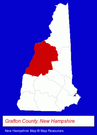
The New Hampshire counties map at upper right shows Grafton County, highlighted in red. Use the menu below to display interactive maps of Hanover, either in a frame on this page or in full-screen mode.
Use the menu below to display categorized Hanover directories.
| Hanover Products and Services Directory | ||
|---|---|---|
| Dentists | Orthodontics Dentists | Restaurants |
Selected Hanover, New Hampshire Listings
These representative Hanover listings provide some insight into the place's cultural environment and economic climate.- Orthodontics Dentists
- Financial Services
- Financing
- Chiropractors
- Holistic Health Practitioners
- Financial Services
- Investment Services
- Investment Advisory Services
- Steak Restaurants
- Orthodontics Dentists
- Commercial Printing
- Book Publishers
- Building & Home Construction
- Builders & Contractors
- Building Remodeling & Repair Contractors
- Special Trades Contractors
- Metal Buildings Dealers
- Business Services
- Business Consultants & Advisors
- Management Consultants
- Business Management Services
Nearby New Hampshire Cities and Towns *
- Concord (23) - Concord, New Hampshire solutions directory and maps.
- Hebron (2) - Hebron, New Hampshire information and maps.
- Keene (9) - Keene, New Hampshire demographics and directory.
- Lebanon (1) - Lebanon, New Hampshire information and maps.
- Lincoln (1) - Lincoln, New Hampshire information and maps.
- Meredith (1) - Meredith, New Hampshire information and maps.
* Parenthesized numbers indicate economic activity levels.
Copyright © 2011-2026 RegionalDirectory.us. All rights reserved.