Lebanon, New Hampshire Map and Directory
Regional Directory > States Menu > New Hampshire
 According to the United States Census Bureau, Lebanon is a City that is located in Grafton County, New Hampshire at 43.64 degrees North and 72.25 degrees West.
The city's time zone is America/New York, and the city's primary telephone area code is 603.
The land area of Lebanon is about 40.32 square miles, whereas the water area of the city is about 1.01 square miles.
Grafton County's land area is about 1,709 square miles, so the city occupies about 2.4 percent of the county's total land area.
According to the United States Census Bureau, Lebanon is a City that is located in Grafton County, New Hampshire at 43.64 degrees North and 72.25 degrees West.
The city's time zone is America/New York, and the city's primary telephone area code is 603.
The land area of Lebanon is about 40.32 square miles, whereas the water area of the city is about 1.01 square miles.
Grafton County's land area is about 1,709 square miles, so the city occupies about 2.4 percent of the county's total land area.
The Census Bureau estimates that Lebanon had about 13,651 residents in 2019, which is approximately 339 people per square mile of land area.
According to recent American Community Survey data, the median household income in Lebanon was about $67,698 per year.
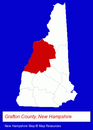
The New Hampshire counties map at upper right shows Grafton County, highlighted in red. Use the menu below to display interactive maps of Lebanon, either in a frame on this page or in full-screen mode.
Use the menu below to display categorized Lebanon directories.
| Lebanon Directory Page: | Dentists |
|---|
Selected Lebanon, New Hampshire Listings
These Lebanon listings provide some insight into the city's cultural environment and economic climate.- Landscape Contractors
- Landscape Equipment & Supplies Dealers
- Auto Service & Repair
- Truck Service & Repair
- Insurance
- Insurance Consultants & Advisors
- Insurance
- Homes & Residential Real Estate
- Real Estate Agencies & Brokerage
- Escrow Services
- Metals
- Limousine Services
- Retirement Planning Consultants & Services
- Accountants
- Certified Public Accountants
- Restaurants
- Chinese Restaurants
- Japanese Restaurants
- Hotels
- Hotel & Motel Reservations
- Health Clubs & Gyms
- Recreation Centers
- Emergency Services Dentists
- Veterinarians
- Animal Hospitals
Nearby New Hampshire Cities and Towns *
- Concord (23) - Concord, New Hampshire solutions directory and maps.
- Keene (9) - Keene, New Hampshire demographics and directory.
- Laconia (4) - Laconia, New Hampshire information and maps.
* Parenthesized numbers indicate economic activity levels.
Copyright © 2011-2026 RegionalDirectory.us. All rights reserved.