Peterborough, New Hampshire Map and Directory
Regional Directory > States Menu > New Hampshire
 According to the United States Census Bureau, Peterborough is a Town that is located in Hillsborough County, New Hampshire at 42.89 degrees North and 71.94 degrees West.
The town's time zone is America/New York, and the town's primary telephone area code is 603.
The land area of Peterborough is about 37.72 square miles, whereas the water area of the town is about 0.41 square miles.
Hillsborough County's land area is about 876 square miles, so the town occupies about 4.3 percent of the county's total land area.
According to the United States Census Bureau, Peterborough is a Town that is located in Hillsborough County, New Hampshire at 42.89 degrees North and 71.94 degrees West.
The town's time zone is America/New York, and the town's primary telephone area code is 603.
The land area of Peterborough is about 37.72 square miles, whereas the water area of the town is about 0.41 square miles.
Hillsborough County's land area is about 876 square miles, so the town occupies about 4.3 percent of the county's total land area.
The Census Bureau estimates that Peterborough had about 6,604 residents in 2019, which is approximately 175 people per square mile of land area.
According to recent American Community Survey data, the median household income in Peterborough was about $87,557 per year.
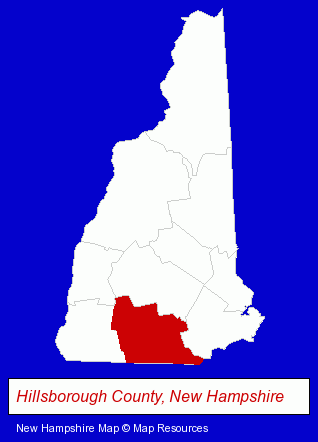
The New Hampshire counties map at upper right shows Hillsborough County, highlighted in red. Use the menu below to display interactive maps of Peterborough, either in a frame on this page or in full-screen mode.
Use the menu below to display categorized Peterborough directories.
| Peterborough Products and Services Directory | ||
|---|---|---|
| Dentists | Information Technology | Restaurants |
Selected Peterborough, New Hampshire Listings
These representative Peterborough listings provide some insight into the town's cultural environment and economic climate.- Fuel Oils
- Petroleum Oils Retail
- Candy & Confectionery Retail
- Baking Products
- Chocolate & Cocoa Retail
- Internet Products & Services
- Web Site Design
- Web Sites
- Optometrists
- Optical Goods Retail
- Contact Lenses
- Steak Restaurants
- Take Out
- Delicatessens
- Clothing Stores
- Clothing & Accessories Retail
- Gift Shops
- Jewelers
- Builders & Contractors
- Building Contractors
- Card Shops
- Heating Contractors
- Heating & Ventilating Contractors
- Beauty Salons
- Manicures & Pedicures
- Computer Software
- Web Site Design
- Web Sites
- Web Site Developers
- Web Site Hosting
- Internet Development
- Specialty & Gourmet Foods Retail
- Gourmet Foods Retail
Nearby New Hampshire Cities and Towns *
- Amherst (7) - Amherst, New Hampshire demographics and maps.
- Bedford (10) - Bedford, New Hampshire demographics and directory.
- Bow (3) - Bow, New Hampshire information and maps.
- Keene (9) - Keene, New Hampshire demographics and directory.
- Manchester (39) - Manchester, New Hampshire products & services directory.
- Merrimack (7) - Merrimack, New Hampshire demographics and maps.
- Nashua (20) - Nashua, New Hampshire solutions directory and maps.
* Parenthesized numbers indicate economic activity levels.
Copyright © 2011-2026 RegionalDirectory.us. All rights reserved.