Voorhees, New Jersey Map and Directory
Regional Directory > States Menu > New Jersey
 According to the United States Census Bureau, Voorhees is a Township that is located in Camden County, New Jersey at 39.85 degrees North and 74.95 degrees West.
The township's time zone is America/New York, and the township's primary telephone area code is 856.
The land area of Voorhees is about 11.49 square miles, whereas the water area of the township is about 0.17 square miles.
Camden County's land area is about 221 square miles, so the township occupies about 5.2 percent of the county's total land area.
According to the United States Census Bureau, Voorhees is a Township that is located in Camden County, New Jersey at 39.85 degrees North and 74.95 degrees West.
The township's time zone is America/New York, and the township's primary telephone area code is 856.
The land area of Voorhees is about 11.49 square miles, whereas the water area of the township is about 0.17 square miles.
Camden County's land area is about 221 square miles, so the township occupies about 5.2 percent of the county's total land area.
The Census Bureau estimates that Voorhees had about 29,212 residents in 2019, which is approximately 2,542 people per square mile of land area.
According to recent American Community Survey data, the median household income in Voorhees was about $98,906 per year.
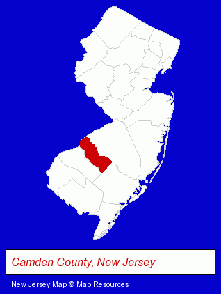
The New Jersey counties map at upper right shows Camden County, highlighted in red. Use the menu below to display interactive maps of Voorhees, either in a frame on this page or in full-screen mode.
Use the menu below to display categorized Voorhees directories.
| Voorhees Products and Services Directory | ||
|---|---|---|
| Clinics | Physicians | Schools |
Selected Voorhees, New Jersey Listings
These representative Voorhees listings provide some insight into the township's cultural environment and economic climate.- Cosmetic Dentists
- Periodontics Dentists
- Oral Surgeons
- Insurance
- Vocational Education
- Business Education
- Optometrists
- Contact Lenses
- Orthodontics Dentists
- Ophthalmology Physicians & Surgeons
- Building & Home Construction
- Architects
- Architectural Services
- Outdoor Sports & Recreation
- Public Golf Courses
- Golf
- Golf Courses
- Miniature Golf Courses
- Pizza Restaurants
- Take Out
- Family Restaurants
- Metals
- Sheet Metal Wholesale & Manufacturers
- Elementary & Secondary Education
- Elementary Schools
- Cosmetic & Reconstructive Surgeons
- Surgeons
- Surgeons
- Neurology Physicians & Surgeons
Nearby New Jersey Cities and Towns *
- Cherry Hill (12) - Cherry Hill, New Jersey demographics and directory.
- Moorestown (5) - Moorestown, New Jersey demographics and maps.
- Pennsauken (3) - Pennsauken, New Jersey information and maps.
Large and Mid-size Cities in Nearby States
- Philadelphia, Pennsylvania (86) - Philadelphia, PA products & services directory.
* Parenthesized numbers indicate economic activity levels.
Copyright © 2011-2026 RegionalDirectory.us. All rights reserved.