Glens Falls, New York Map and Directory
Regional Directory > States Menu > New York
 According to the United States Census Bureau, Glens Falls is a City that is located in Warren County, New York at 43.31 degrees North and 73.64 degrees West.
The city's time zone is America/New York, and the city's primary telephone area code is 518.
The land area of Glens Falls is about 3.85 square miles, whereas the water area of the city is about 0.14 square miles.
Warren County's land area is about 867 square miles, so the city occupies about 0.4 percent of the county's total land area.
According to the United States Census Bureau, Glens Falls is a City that is located in Warren County, New York at 43.31 degrees North and 73.64 degrees West.
The city's time zone is America/New York, and the city's primary telephone area code is 518.
The land area of Glens Falls is about 3.85 square miles, whereas the water area of the city is about 0.14 square miles.
Warren County's land area is about 867 square miles, so the city occupies about 0.4 percent of the county's total land area.
The Census Bureau estimates that Glens Falls had about 14,262 residents in 2019, which is approximately 3,704 people per square mile of land area.
According to recent American Community Survey data, the median household income in Glens Falls was about $50,071 per year.
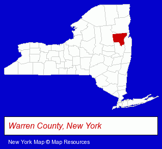
The New York counties map at upper right shows Warren County, highlighted in red. Use the menu below to display interactive maps of Glens Falls, either in a frame on this page or in full-screen mode.
Use the menu below to display categorized Glens Falls directories.
| Glens Falls Directory Page: | Building Materials |
|---|
Selected Glens Falls, New York Listings
These Glens Falls listings provide some insight into the city's cultural environment and economic climate.- Building Contractors
- Roofing Contractors
- Educational Consultants
- Insurance
- Financial Guaranty & Life Insurance
- Real Estate Attorneys
- Bankruptcy Attorneys
- Traffic Law Attorneys
- Cultural Attractions, Events & Facilities
- Tourist Information & Attractions
- Museums
- Credit Unions
- Cultural Attractions, Events & Facilities
- Libraries
- Accounting, Auditing & Bookkeeping Services
- Tax Return Preparation
- Payroll & Payroll Tax Preparation Services
- Financial Services
- Financial Planning Consultants & Services
- Clothing Stores
- Commercial & Graphic Artists
- Industrial Equipment & Supplies Dealers
- Special Trades Contractors
- Mechanical Contractors
- Auto Insurance
- Urology Physicians & Surgeons
- Engineers
- Civil Engineers
- Structural Engineers
- Carpet, Rug & Upholstery Cleaning
- Carpet, Rug & Upholstery Cleaning Commercial & Industrial
- Window Cleaning
- Pressure Cleaning
- Window Cleaning Commercial & Industrial
Nearby New York Cities and Towns *
- Ballston Spa (4) - Ballston Spa, New York information and maps.
- Bolton Landing (1) - Bolton Landing, New York information and maps.
- Clifton Park (7) - Clifton Park, New York demographics and maps.
- Lake George (6) - Lake George, New York demographics and maps.
- Queensbury (2) - Queensbury, New York information and maps.
- Saratoga Springs (18) - Saratoga Springs, New York solutions directory and maps.
- Schenectady (17) - Schenectady, New York solutions directory and maps.
* Parenthesized numbers indicate economic activity levels.
Copyright © 2011-2026 RegionalDirectory.us. All rights reserved.