Saratoga Springs, New York Map and Directory
Regional Directory > States Menu > New York
 According to the United States Census Bureau, Saratoga Springs is a City that is located in Saratoga County, New York at 43.08 degrees North and 73.78 degrees West.
The city's time zone is America/New York, and the city's primary telephone area code is 518.
The land area of Saratoga Springs is about 28.06 square miles, whereas the water area of the city is about 0.81 square miles.
Saratoga County's land area is about 810 square miles, so the city occupies about 3.5 percent of the county's total land area.
According to the United States Census Bureau, Saratoga Springs is a City that is located in Saratoga County, New York at 43.08 degrees North and 73.78 degrees West.
The city's time zone is America/New York, and the city's primary telephone area code is 518.
The land area of Saratoga Springs is about 28.06 square miles, whereas the water area of the city is about 0.81 square miles.
Saratoga County's land area is about 810 square miles, so the city occupies about 3.5 percent of the county's total land area.
The Census Bureau estimates that Saratoga Springs had about 28,212 residents in 2019, which is approximately 1,005 people per square mile of land area.
According to recent American Community Survey data, the median household income in Saratoga Springs was about $82,816 per year.
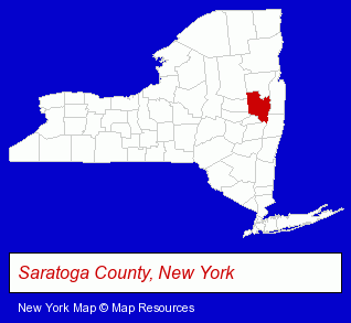
The New York counties map at upper right shows Saratoga County, highlighted in red. Use the menu below to display interactive maps of Saratoga Springs, either in a frame on this page or in full-screen mode.
Use the menu below to display categorized Saratoga Springs directories.
| Saratoga Springs Products and Services Directory | ||
|---|---|---|
| American Restaurants | Attorneys | Chiropractors |
| Dentists | Home Improvement | Hotels |
| Information Technology | Physicians | Restaurants |
| Schools | Visual Arts | |
Selected Saratoga Springs, New York Listings
These randomly selected Saratoga Springs listings provide some insight into the city's cultural environment and economic climate.- Heating & Air Conditioning Contractors
- Cable Television Services
- Appliance Dealers
- Small Appliance Dealers
- Coffee & Tea Shops
- Contact Lenses
- Eyewear
- Bar & Grill Restaurants
- Security Systems & Services
- Door & Door Frame Dealers
- Engineers
- Landscape Contractors
- Landscape Services
- Consulting Engineers
- Landscape Designers & Consultants
- Auto Insurance
- Property & Casualty Insurance
- Orthopedics Physicians & Surgeons
- Sports Medicine Physicians & Surgeons
- Building Contractors
- Architects
- Architectural Engineers
- Sports & Recreation Facilities
- Health Clubs & Gyms
- Banks
- Bowling Alleys
- Cultural Attractions, Events & Facilities
- Libraries
- Personal Injury Attorneys
- Trial Attorneys
- Construction Law Attorneys
- Product Liability Law Attorneys
- Financial Planning Consultants & Services
- Financing
- Retirement Planning Consultants & Services
- Estate Planning & Administration
- Lawn & Garden Equipment & Supplies Retail
- Pet Food & Supplies Retail
- Pet Shops
- Lawn & Garden Furnishings
- Birds & Supplies
Nearby New York Cities and Towns *
- Ballston Spa (4) - Ballston Spa, New York information and maps.
- Clifton Park (7) - Clifton Park, New York demographics and maps.
- Glens Falls (1) - Glens Falls, New York information and maps.
- Lake George (6) - Lake George, New York demographics and maps.
- Queensbury (2) - Queensbury, New York information and maps.
- Schenectady (17) - Schenectady, New York solutions directory and maps.
- Troy (11) - Troy, New York demographics and directory.
* Parenthesized numbers indicate economic activity levels.
Copyright © 2011-2026 RegionalDirectory.us. All rights reserved.