Dover, Ohio Map and Directory
Regional Directory > States Menu > Ohio
 According to the United States Census Bureau, Dover is a City that is located in Tuscarawas County, Ohio at 40.52 degrees North and 81.47 degrees West.
The city's time zone is America/New York, and the city's primary telephone area code is 330.
The land area of Dover is about 5.69 square miles, whereas the water area of the city is about 0.10 square miles.
Tuscarawas County's land area is about 568 square miles, so the city occupies about 1.0 percent of the county's total land area.
According to the United States Census Bureau, Dover is a City that is located in Tuscarawas County, Ohio at 40.52 degrees North and 81.47 degrees West.
The city's time zone is America/New York, and the city's primary telephone area code is 330.
The land area of Dover is about 5.69 square miles, whereas the water area of the city is about 0.10 square miles.
Tuscarawas County's land area is about 568 square miles, so the city occupies about 1.0 percent of the county's total land area.
The Census Bureau estimates that Dover had about 12,723 residents in 2019, which is approximately 2,236 people per square mile of land area.
According to recent American Community Survey data, the median household income in Dover was about $56,898 per year.
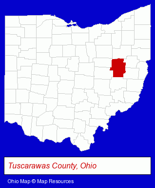
The Ohio counties map at upper right shows Tuscarawas County, highlighted in red. Use the menu below to display interactive maps of Dover, either in a frame on this page or in full-screen mode.
Use the menu below to display categorized Dover directories.
| Dover Directory Page: | Physicians |
|---|
Selected Dover, Ohio Listings
These Dover listings provide some insight into the city's cultural environment and economic climate.- Auctions
- Auctioneers & Auction Houses
- Attorneys
- Corporate Business Attorneys
- Family Law Attorneys
- Estate Planning & Administration Attorneys
- Real Estate Attorneys
- Visual Arts
- Crafts & Craft Supplies Retail
- Plastic & Plastic Products Wholesale & Manufacturers
- Libraries
- Metals
- Printing & Publishing
- Printing Services
- Commercial Printing
- Computer Printers
- Computer Supplies, Parts & Accessories
- Medical Services
- Gynecology & Obstetrics Physicians & Surgeons
- Vascular Medicine Physicians & Surgeons
- Landscape Contractors
- Landscape Services
- Landscape Designers & Consultants
- Ophthalmology Physicians & Surgeons
- Urology Physicians & Surgeons
Nearby Ohio Cities and Towns *
- Akron (38) - Akron, Ohio products & services directory.
- Canton (21) - Canton, Ohio solutions directory and maps.
- Massillon (4) - Massillon, Ohio information and maps.
- North Canton (10) - North Canton, Ohio demographics and directory.
- Orrville (1) - Orrville, Ohio information and maps.
- Wooster (8) - Wooster, Ohio demographics and maps.
Large and Mid-size Cities in Nearby States
- Wheeling, West Virginia (4) - Wheeling, WV information and maps.
* Parenthesized numbers indicate economic activity levels.
Copyright © 2011-2026 RegionalDirectory.us. All rights reserved.