Warwick, Rhode Island Map and Directory
Regional Directory > States Menu > Rhode Island
 According to the United States Census Bureau, Warwick is a City that is located in Kent County, Rhode Island at 41.70 degrees North and 71.42 degrees West.
The city's time zone is America/New York, and the city's primary telephone area code is 401.
The land area of Warwick is about 35.04 square miles, whereas the water area of the city is about 14.75 square miles.
Kent County's land area is about 169 square miles, so the city occupies about 20.7 percent of the county's total land area.
According to the United States Census Bureau, Warwick is a City that is located in Kent County, Rhode Island at 41.70 degrees North and 71.42 degrees West.
The city's time zone is America/New York, and the city's primary telephone area code is 401.
The land area of Warwick is about 35.04 square miles, whereas the water area of the city is about 14.75 square miles.
Kent County's land area is about 169 square miles, so the city occupies about 20.7 percent of the county's total land area.
The Census Bureau estimates that Warwick had about 81,004 residents in 2019, which is approximately 2,312 people per square mile of land area.
According to recent American Community Survey data, the median household income in Warwick was about $73,757 per year.
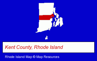
The Rhode Island counties map at upper right shows Kent County, highlighted in red. Use the menu below to display interactive maps of Warwick, either in a frame on this page or in full-screen mode.
Use the menu below to display categorized Warwick directories.
| Warwick Products and Services Directory | ||
|---|---|---|
| Accountants | Attorneys | Building Materials |
| Business Services | Dentists | Financial Services |
| Home Improvement | Insurance | Metals |
| Optometrists | Physicians | Restaurants |
| Schools | Visual Arts | |
Selected Warwick, Rhode Island Listings
These randomly selected Warwick listings provide some insight into the city's cultural environment and economic climate.- Industrial Equipment & Supplies Dealers
- Metals
- Medical Equipment & Supplies Retail
- Importers
- Medical Equipment & Supplies Retail
- Plastic & Plastic Products Wholesale & Manufacturers
- Public Accountants
- Certified Public Accountants
- Medical Equipment & Supplies Retail
- Medical Equipment & Supplies Wholesale & Manufacturers
- Surgical Instruments Wholesale & Manufacturers
- Dental Equipment & Supplies
- Pictures & Prints Retail
- Metal Finishing
- Pediatrics Physicians & Surgeons
- Gynecology & Obstetrics Physicians & Surgeons
- Endocrinology & Metabolism Physicians & Surgeons
- Private Schools
- Educational Services
- Religious Education Schools
- Personal Injury Attorneys
- Employment & Labor Law Attorneys
- Trial Attorneys
- Private Golf Courses
- Private Golf Clubs
- Civic Clubs & Organizations
- Sports & Recreation Clubs & Organizations
- Private Golf Courses
- Private Golf Clubs
- Country Clubs
- Chinese Restaurants
Nearby Rhode Island Cities and Towns *
- Cranston (9) - Cranston, Rhode Island demographics and directory.
- North Kingstown (2) - North Kingstown, Rhode Island information and maps.
- Pawtucket (4) - Pawtucket, Rhode Island information and maps.
- Providence (27) - Providence, Rhode Island solutions directory and maps.
Large and Mid-size Cities in Nearby States
- Fall River, Massachusetts (10) - Fall River, MA demographics and maps.
- Attleboro, Massachusetts (7) - Attleboro, MA demographics and maps.
* Parenthesized numbers indicate economic activity levels.
Copyright © 2011-2026 RegionalDirectory.us. All rights reserved.