College Station, Texas Map and Directory
Regional Directory > States Menu > Texas
 According to the United States Census Bureau, College Station is a City that is located in Brazos County, Texas at 30.63 degrees North and 96.33 degrees West.
The city's time zone is America/Chicago, and the city's primary telephone area code is 979.
The land area of College Station is about 50.64 square miles, whereas the water area of the city is about 0.13 square miles.
Brazos County's land area is about 585 square miles, so the city occupies about 8.7 percent of the county's total land area.
According to the United States Census Bureau, College Station is a City that is located in Brazos County, Texas at 30.63 degrees North and 96.33 degrees West.
The city's time zone is America/Chicago, and the city's primary telephone area code is 979.
The land area of College Station is about 50.64 square miles, whereas the water area of the city is about 0.13 square miles.
Brazos County's land area is about 585 square miles, so the city occupies about 8.7 percent of the county's total land area.
The Census Bureau estimates that College Station had about 117,911 residents in 2019, which is approximately 2,328 people per square mile of land area.
According to recent American Community Survey data, the median household income in College Station was about $45,820 per year. This College Station Real Estate directory lists real estate solution providers in College Station, Texas.
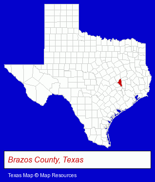
The Texas counties map at upper right shows Brazos County, highlighted in red. Use the menu below to display interactive maps of College Station, either in a frame on this page or in full-screen mode.
Use the menu below to display categorized College Station directories.
| College Station Products and Services Directory | ||
|---|---|---|
| Attorneys | Clothing Stores | Financial Services |
| Home Improvement | Insurance | Physicians |
| Restaurants | Schools | Steak Restaurants |
| Veterinarians | Visual Arts | |
Selected College Station, Texas Listings
These randomly selected College Station listings provide some insight into the city's cultural environment and economic climate.- Outdoor Sports & Recreation
- Boat Dealers
- Motorcycle, Motor Scooter & Minibike Dealers
- Motorcycle, Motor Scooter & Minibike Parts & Accessories
- Real Estate Rental & Leasing
- Property Management
- Rental Management Services
- Real Estate Rental Information & Referral Services
- Rental Vacancy & Listing Service
- Consumer Electronics Stores
- Computer Hardware & Supplies
- Cameras & Camera Supplies
- Electronics
- Digital Cameras
- Health Clubs & Gyms
- Recreation Centers
- Door & Door Frame Dealers
- Art Galleries & Dealers
- Artists & Art Studios
- Fine Art Artists
- Optometrists
- Contact Lenses Retail
- Truck Dealers
- Used Cars
- Used Trucks
- Photography
- Professional Photographers
- Optometrists
- Chiropractors
- Pain Management Physicians & Surgeons
Nearby Texas Cities and Towns *
- Brenham (2) - Brenham, Texas information and maps.
- Bryan (8) - Bryan, Texas demographics and maps.
- Huntsville (1) - Huntsville, Texas information and maps.
- Magnolia (1) - Magnolia, Texas information and maps.
- Montgomery (6) - Montgomery, Texas demographics and maps.
- Tomball (9) - Tomball, Texas demographics and directory.
- Waller (1) - Waller, Texas information and maps.
* Parenthesized numbers indicate economic activity levels.
Copyright © 2011-2026 RegionalDirectory.us. All rights reserved.