Brattleboro, Vermont Map and Directory
Regional Directory > States Menu > Vermont
 According to the United States Census Bureau, Brattleboro is a Town that is located in Windham County, Vermont at 42.86 degrees North and 72.63 degrees West.
The town's time zone is America/New York, and the town's primary telephone area code is 802.
The land area of Brattleboro is about 31.83 square miles, whereas the water area of the town is about 0.58 square miles.
Windham County's land area is about 785 square miles, so the town occupies about 4.1 percent of the county's total land area.
According to the United States Census Bureau, Brattleboro is a Town that is located in Windham County, Vermont at 42.86 degrees North and 72.63 degrees West.
The town's time zone is America/New York, and the town's primary telephone area code is 802.
The land area of Brattleboro is about 31.83 square miles, whereas the water area of the town is about 0.58 square miles.
Windham County's land area is about 785 square miles, so the town occupies about 4.1 percent of the county's total land area.
The Census Bureau estimates that Brattleboro had about 11,524 residents in 2019, which is approximately 362 people per square mile of land area.
According to recent American Community Survey data, the median household income in Brattleboro was about $38,176 per year.
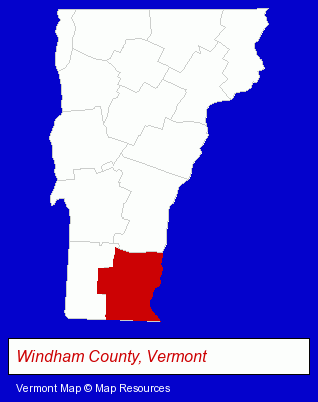
The Vermont counties map at upper right shows Windham County, highlighted in red. Use the menu below to display interactive maps of Brattleboro, either in a frame on this page or in full-screen mode.
Use the menu below to display categorized Brattleboro directories.
| Brattleboro Directory Page: | Home Improvement |
|---|
Selected Brattleboro, Vermont Listings
These Brattleboro listings provide some insight into the town's cultural environment and economic climate.- Sporting Goods Dealers
- Pottery Retail
- Alternative Medicine
- Nutrition
- Food Products Retail
- Natural Healing Products & Services
- Health & Diet Foods Retail
- Fabric Shops
- Take Out
- Delicatessens
- Schools
- Educational Services
- Adult & Continuing Education
- Financial Services
- Investment Services
- Investment Advisory Services
- Information Technology Services
- Internet Products & Services
- Web Site Design
- Web Sites
- Financial Services
- Investment Services
- Investment Advisory Services
- Publishers
- Book Publishers
- Sporting Goods Dealers
- Caterers
- Take Out
- Delicatessens
- Crafts & Craft Supplies Retail
- Housewares Wholesale & Manufacturers
- Hand Blown Glass Retail
Nearby Vermont Cities and Towns *
- Bennington (1) - Bennington, Vermont information and maps.
- Chester (1) - Chester, Vermont information and maps.
- Ludlow (1) - Ludlow, Vermont information and maps.
- Manchester Center (1) - Manchester Center, Vermont information and maps.
- Putney (1) - Putney, Vermont information and maps.
- Rutland (6) - Rutland, Vermont demographics and maps.
* Parenthesized numbers indicate economic activity levels.
Copyright © 2011-2026 RegionalDirectory.us. All rights reserved.