Ludlow, Vermont Map and Directory
Regional Directory > States Menu > Vermont
 According to the United States Census Bureau, Ludlow is a Village that is located in Windsor County, Vermont at 43.40 degrees North and 72.70 degrees West.
The village's time zone is America/New York, and the village's primary telephone area code is 802.
The land area of Ludlow is about 1.34 square miles, whereas the water area of the village is about 0.02 square miles.
Windsor County's land area is about 969 square miles, so the village occupies about 0.1 percent of the county's total land area.
According to the United States Census Bureau, Ludlow is a Village that is located in Windsor County, Vermont at 43.40 degrees North and 72.70 degrees West.
The village's time zone is America/New York, and the village's primary telephone area code is 802.
The land area of Ludlow is about 1.34 square miles, whereas the water area of the village is about 0.02 square miles.
Windsor County's land area is about 969 square miles, so the village occupies about 0.1 percent of the county's total land area.
The Census Bureau estimates that Ludlow had about 795 residents in 2014, which is approximately 593 people per square mile of land area.
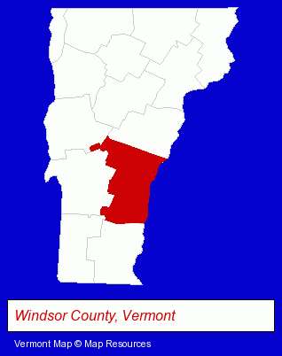
The Vermont counties map at upper right shows Windsor County, highlighted in red. Use the menu below to display interactive maps of Ludlow, either in a frame on this page or in full-screen mode.
Use the menu below to display categorized Ludlow directories.
| Ludlow Directory Page: | Hotels |
|---|
Selected Ludlow, Vermont Listings
These Ludlow listings provide some insight into the village's cultural environment and economic climate. Black River High School- Schools
- Home Improvement & Maintenance
- Restaurants
- Lodging
- Hotels
- Steak Restaurants
- Bed & Breakfasts
- Take Out
- Delicatessens
- Lodging
- Hotels
- Motels
- Lodging
- Hotels
- Hotel & Motel Reservations
Nearby Vermont Cities and Towns *
- Brattleboro (1) - Brattleboro, Vermont information and maps.
- Chester (1) - Chester, Vermont information and maps.
- Killington (1) - Killington, Vermont information and maps.
- Manchester Center (1) - Manchester Center, Vermont information and maps.
- Putney (1) - Putney, Vermont information and maps.
- Rutland (6) - Rutland, Vermont demographics and maps.
* Parenthesized numbers indicate economic activity levels.
Copyright © 2011-2026 RegionalDirectory.us. All rights reserved.