Shingle Springs, California Map and Directory
Regional Directory > States Menu > California
 According to the United States Census Bureau, Shingle Springs is a Census-designated Place that is located in El Dorado County, California at 38.67 degrees North and 120.93 degrees West.
The place's time zone is America/Los Angeles, and the place's primary telephone area code is 530.
The land area of Shingle Springs is about 8.21 square miles, whereas the water area of the place is about 0.03 square miles.
El Dorado County's land area is about 1,708 square miles, so the place occupies about 0.5 percent of the county's total land area.
According to the United States Census Bureau, Shingle Springs is a Census-designated Place that is located in El Dorado County, California at 38.67 degrees North and 120.93 degrees West.
The place's time zone is America/Los Angeles, and the place's primary telephone area code is 530.
The land area of Shingle Springs is about 8.21 square miles, whereas the water area of the place is about 0.03 square miles.
El Dorado County's land area is about 1,708 square miles, so the place occupies about 0.5 percent of the county's total land area.
The Census Bureau estimates that Shingle Springs had about 4,562 residents in 2014, which is approximately 556 people per square mile of land area.
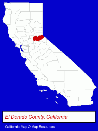
The California counties map at upper right shows El Dorado County, highlighted in red. Use the menu below to display interactive maps of Shingle Springs, either in a frame on this page or in full-screen mode.
Use the menu below to display categorized Shingle Springs directories.
| Shingle Springs Directory Page: | Auto Service |
|---|
Selected Shingle Springs, California Listings
These Shingle Springs listings provide some insight into the place's cultural environment and economic climate.- Energy & Environment
- Solar Energy Systems & Services Retail
- Printing & Publishing
- Advertising
- Advertising & Promotional Product Dealers
- Auto Parts Retail
- Used & Rebuilt Auto Parts Retail
- Financial Services
- Accountants
- Public Accountants
- Accounting, Auditing & Bookkeeping Services
- Certified Public Accountants
- Electronic Equipment & Supplies Wholesale & Manufacturers
- Schools
- Building & Home Construction
- Metals
- Patio, Porch, Deck & Gazebo Builders
- Welding Services
- Welding Contractors
- Auto Parts Wholesale & Manufacturers
- Truck Equipment, Parts & Accessories Retail
- Truck Parts & Equipment Wholesale & Manufacturers
- Chambers of Commerce
- Internet Products & Services
- Computer Software
- Internet Services
- Internet Service Providers
Nearby California Cities and Towns *
- Auburn (12) - Auburn, California demographics and directory.
- Diamond Springs (1) - Diamond Springs, California information and maps.
- El Dorado Hills (2) - El Dorado Hills, California information and maps.
- Folsom (11) - Folsom, California demographics and directory.
- Newcastle (1) - Newcastle, California information and maps.
- Placerville (5) - Placerville, California demographics and maps.
- Rocklin (11) - Rocklin, California demographics and directory.
* Parenthesized numbers indicate economic activity levels.
Copyright © 2011-2026 RegionalDirectory.us. All rights reserved.