Nevada City, California Map and Directory
Regional Directory > States Menu > California
 According to the United States Census Bureau, Nevada City is a City that is located in Nevada County, California at 39.26 degrees North and 121.02 degrees West.
The city's time zone is America/Los Angeles, and the city's primary telephone area code is 530.
The land area of Nevada City is about 2.19 square miles, whereas the water area of the city is about 0.00 square miles.
Nevada County's land area is about 958 square miles, so the city occupies about 0.2 percent of the county's total land area.
According to the United States Census Bureau, Nevada City is a City that is located in Nevada County, California at 39.26 degrees North and 121.02 degrees West.
The city's time zone is America/Los Angeles, and the city's primary telephone area code is 530.
The land area of Nevada City is about 2.19 square miles, whereas the water area of the city is about 0.00 square miles.
Nevada County's land area is about 958 square miles, so the city occupies about 0.2 percent of the county's total land area.
The Census Bureau estimates that Nevada City had about 3,028 residents in 2014, which is approximately 1,383 people per square mile of land area.
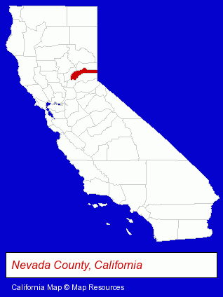
The California counties map at upper right shows Nevada County, highlighted in red. Use the menu below to display interactive maps of Nevada City, either in a frame on this page or in full-screen mode.
Use the menu below to display categorized Nevada City directories.
| Nevada City Products and Services Directory | ||
|---|---|---|
| Architects | Printing and Publishing | Restaurants |
| Steak Restaurants | ||
Selected Nevada City, California Listings
These randomly selected Nevada City listings provide some insight into the city's cultural environment and economic climate.- Veterinarians
- Animal Hospitals
- Clothing & Accessories Retail
- Clothing Wholesale & Manufacturers
- Clothing & Accessories Cleaning & Repair
- Shoe Stores
- Leather Clothing Wholesale & Manufacturers
- Building & Home Construction
- Architects
- Architectural Services
- Real Estate Inspection Services
- Home & Building Inspection
- Museums
- Cultural Attractions, Events & Facilities
- Tourist Information & Attractions
- Museums
- Auto Dealers
- Transportation Services
- Arts Organizations & Information
- Building & Home Construction
- Building Contractors
- Building & Home Construction
- Building Contractors
Nearby California Cities and Towns *
- Auburn (12) - Auburn, California demographics and directory.
- Grass Valley (7) - Grass Valley, California demographics and maps.
- Loomis (3) - Loomis, California information and maps.
- Placerville (5) - Placerville, California demographics and maps.
- Rocklin (11) - Rocklin, California demographics and directory.
- Roseville (30) - Roseville, California solutions directory and maps.
Large and Mid-size Cities in Nearby States
- Incline Village, Nevada (4) - Incline Village, NV information and maps.
* Parenthesized numbers indicate economic activity levels.
Copyright © 2011-2026 RegionalDirectory.us. All rights reserved.