Oroville, California Map and Directory
Regional Directory > States Menu > California
 According to the United States Census Bureau, Oroville is a City that is located in Butte County, California at 39.51 degrees North and 121.56 degrees West.
The city's time zone is America/Los Angeles, and the city's primary telephone area code is 530.
The land area of Oroville is about 13.21 square miles, whereas the water area of the city is about 0.02 square miles.
Butte County's land area is about 1,636 square miles, so the city occupies about 0.8 percent of the county's total land area.
According to the United States Census Bureau, Oroville is a City that is located in Butte County, California at 39.51 degrees North and 121.56 degrees West.
The city's time zone is America/Los Angeles, and the city's primary telephone area code is 530.
The land area of Oroville is about 13.21 square miles, whereas the water area of the city is about 0.02 square miles.
Butte County's land area is about 1,636 square miles, so the city occupies about 0.8 percent of the county's total land area.
The Census Bureau estimates that Oroville had about 20,737 residents in 2019, which is approximately 1,570 people per square mile of land area.
According to recent American Community Survey data, the median household income in Oroville was about $34,428 per year.
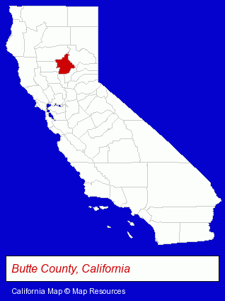
The California counties map at upper right shows Butte County, highlighted in red. Use the menu below to display interactive maps of Oroville, either in a frame on this page or in full-screen mode.
Use the menu below to display categorized Oroville directories.
| Oroville Directory Page: | Building Materials |
|---|
Selected Oroville, California Listings
These Oroville listings provide some insight into the city's cultural environment and economic climate.- Event Planning
- Party Planning
- Paintball Facilities
- Metal Buildings Dealers
- Building & Home Construction
- Homes & Residential Real Estate
- Prefabricated & Modular Buildings
- Mobile Home Service, Repair & Improvements
- Mobile & Modular Home Washing & Cleaning
- Airport Transportation
- Auto Transport
- Limousine Services
- Fruits & Vegetables Retail
- Fruits & Vegetables Wholesale
- Vegetable Oils
- Olive Oil Wholesale
- Libraries
- Building Materials & Supplies Wholesale & Manufacturers
- Moving & Storage Commercial & Industrial
- Moving & Storage Equipment & Supplies Retail
- Boxes & Bags Retail
- Plastic & Transparent Boxes Retail
- Boarding Stables
- Equestrian Sports & Recreation
- Horseback Riding
- Utilities
- Water & Sewage Companies
- Water Utility Companies
- Dentists
- General Anesthesia & Sedation Dentists
Nearby California Cities and Towns *
- Auburn (12) - Auburn, California demographics and directory.
- Chico (26) - Chico, California solutions directory and maps.
- Grass Valley (7) - Grass Valley, California demographics and maps.
- Lincoln (1) - Lincoln, California information and maps.
- Nevada City (4) - Nevada City, California information and maps.
- Rocklin (11) - Rocklin, California demographics and directory.
- Yuba City (5) - Yuba City, California demographics and maps.
* Parenthesized numbers indicate economic activity levels.
Copyright © 2011-2026 RegionalDirectory.us. All rights reserved.