Truckee, California Map and Directory
Regional Directory > States Menu > California
 According to the United States Census Bureau, Truckee is a Town that is located in Nevada County, California at 39.33 degrees North and 120.18 degrees West.
The town's time zone is America/Los Angeles, and the town's primary telephone area code is 530.
The land area of Truckee is about 32.32 square miles, whereas the water area of the town is about 1.33 square miles.
Nevada County's land area is about 958 square miles, so the town occupies about 3.4 percent of the county's total land area.
According to the United States Census Bureau, Truckee is a Town that is located in Nevada County, California at 39.33 degrees North and 120.18 degrees West.
The town's time zone is America/Los Angeles, and the town's primary telephone area code is 530.
The land area of Truckee is about 32.32 square miles, whereas the water area of the town is about 1.33 square miles.
Nevada County's land area is about 958 square miles, so the town occupies about 3.4 percent of the county's total land area.
The Census Bureau estimates that Truckee had about 16,735 residents in 2019, which is approximately 518 people per square mile of land area.
According to recent American Community Survey data, the median household income in Truckee was about $97,092 per year.
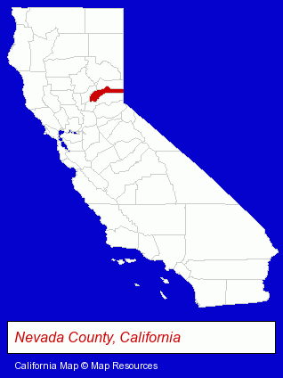
The California counties map at upper right shows Nevada County, highlighted in red. Use the menu below to display interactive maps of Truckee, either in a frame on this page or in full-screen mode.
Use the menu below to display categorized Truckee directories.
| Truckee Products and Services Directory | ||
|---|---|---|
| Architects | Attorneys | Auto Service |
| Building Materials | Dentists | Home Improvement |
| Painting Contractors | Restaurants | Visual Arts |
Selected Truckee, California Listings
These randomly selected Truckee listings provide some insight into the town's cultural environment and economic climate.- Criminal Law Attorneys
- Insurance Law Attorneys
- DUI and DWI Attorneys
- Sporting Goods Dealers
- Billiards Equipment & Supplies Dealers
- Educational Services
- Educational Consultants
- American Restaurants
- Take Out
- Family Restaurants
- Fast Food Restaurants
- Photography
- Professional Photographers
- Specialty Photographers
- Aerial Photographers
- Carpet & Rug Dealers
- Landscape Contractors
- Landscape Services
- Landscape Designers & Consultants
- Landscape Architects
- Excavation Contractors
- Insurance
- Building & Home Construction
- Architects
- Architectural Services
- Commercial & Industrial Architects
- Resorts & Vacation Cottages
- Ski Shops
- Ski Resorts
- Ski & Snowboard Instruction
- Home Improvement Stores
- Hardware Dealers
- Siding Material Dealers
- Landscape Contractors
- Lawn & Garden Equipment & Supplies Retail
- Landscape Designers & Consultants
Nearby California Cities and Towns *
- Auburn (12) - Auburn, California demographics and directory.
- Diamond Springs (1) - Diamond Springs, California information and maps.
- Grass Valley (7) - Grass Valley, California demographics and maps.
- Kings Beach (1) - Kings Beach, California information and maps.
- Nevada City (4) - Nevada City, California information and maps.
- Placerville (5) - Placerville, California demographics and maps.
- South Lake Tahoe (8) - South Lake Tahoe, California demographics and maps.
Large and Mid-size Cities in Nearby States
- Carson City, Nevada (8) - Carson City, NV demographics and maps.
- Reno, Nevada (46) - Reno, NV solutions directory and maps.
- Sparks, Nevada (6) - Sparks, NV information and maps.
* Parenthesized numbers indicate economic activity levels.
Copyright © 2011-2026 RegionalDirectory.us. All rights reserved.