Dubuque, Iowa Map and Directory
Regional Directory > States Menu > Iowa
 According to the United States Census Bureau, Dubuque is a City that is located in Dubuque County, Iowa at 42.50 degrees North and 90.66 degrees West.
The city's time zone is America/Chicago, and the city's primary telephone area code is 563.
The land area of Dubuque is about 30.44 square miles, whereas the water area of the city is about 1.08 square miles.
Dubuque County's land area is about 608 square miles, so the city occupies about 5.0 percent of the county's total land area.
According to the United States Census Bureau, Dubuque is a City that is located in Dubuque County, Iowa at 42.50 degrees North and 90.66 degrees West.
The city's time zone is America/Chicago, and the city's primary telephone area code is 563.
The land area of Dubuque is about 30.44 square miles, whereas the water area of the city is about 1.08 square miles.
Dubuque County's land area is about 608 square miles, so the city occupies about 5.0 percent of the county's total land area.
The Census Bureau estimates that Dubuque had about 57,882 residents in 2019, which is approximately 1,902 people per square mile of land area.
According to recent American Community Survey data, the median household income in Dubuque was about $54,234 per year.
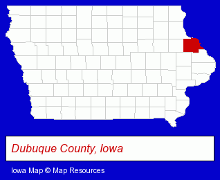
The Iowa counties map at upper right shows Dubuque County, highlighted in red. Use the menu below to display interactive maps of Dubuque, either in a frame on this page or in full-screen mode.
Use the menu below to display categorized Dubuque directories.
| Dubuque Products and Services Directory | ||
|---|---|---|
| Attorneys | Building Materials | Clinics |
| Dentists | Home Improvement | Physicians |
| Printing and Publishing | Restaurants | Schools |
| Visual Arts | ||
Selected Dubuque, Iowa Listings
These randomly selected Dubuque listings provide some insight into the city's cultural environment and economic climate.- Title Insurance
- Real Estate Title Search & Abstract Services
- Publishing Consultants & Services
- Metals
- Metal Products
- Metal Products Wholesale & Manufacturers
- Libraries
- Industrial Equipment Rebuilding, Service & Repair
- Machine Shops
- Auto Machine Shop Services
- Auto Engine Service & Repair
- Elementary & Secondary Education
- Private Schools
- Religious Education Schools
- Catholic Schools
- Alternative Medicine
- Chiropractors
- Alternative Medicine Practitioners
- Medical Equipment & Supplies Retail
- Laboratories
- Research & Development Laboratories
- Home Furnishings Stores
- Housewares Stores
- Clock Dealers & Repair
- Kitchenware & Glassware Retail
- Publishers
- Magazine & Journal Publishers
- Art Galleries & Dealers
- Corporate Business Attorneys
- Personal Injury Attorneys
- Employment & Labor Law Attorneys
- Home Improvement Stores
- Lumber Dealers
- Building & Home Construction
- Architects
- Architectural Services
Nearby Iowa Cities and Towns *
- Bettendorf (7) - Bettendorf, Iowa demographics and maps.
- Cedar Falls (7) - Cedar Falls, Iowa demographics and maps.
- Cedar Rapids (19) - Cedar Rapids, Iowa solutions directory and maps.
- Davenport (19) - Davenport, Iowa solutions directory and maps.
- Eldridge (1) - Eldridge, Iowa information and maps.
- Iowa City (8) - Iowa City, Iowa demographics and maps.
- Waterloo (6) - Waterloo, Iowa demographics and maps.
* Parenthesized numbers indicate economic activity levels.
Copyright © 2011-2026 RegionalDirectory.us. All rights reserved.