Frankfort, Kentucky Map and Directory
Regional Directory > States Menu > Kentucky
 According to the United States Census Bureau, Frankfort is a City that is located in Franklin County, Kentucky at 38.20 degrees North and 84.87 degrees West.
The city's time zone is America/New York, and the city's primary telephone area code is 502.
The land area of Frankfort is about 14.77 square miles, whereas the water area of the city is about 0.30 square miles.
Franklin County's land area is about 208 square miles, so the city occupies about 7.1 percent of the county's total land area.
According to the United States Census Bureau, Frankfort is a City that is located in Franklin County, Kentucky at 38.20 degrees North and 84.87 degrees West.
The city's time zone is America/New York, and the city's primary telephone area code is 502.
The land area of Frankfort is about 14.77 square miles, whereas the water area of the city is about 0.30 square miles.
Franklin County's land area is about 208 square miles, so the city occupies about 7.1 percent of the county's total land area.
The Census Bureau estimates that Frankfort had about 27,755 residents in 2019, which is approximately 1,879 people per square mile of land area.
According to recent American Community Survey data, the median household income in Frankfort was about $50,211 per year.
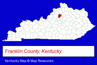
The Kentucky counties map at upper right shows Franklin County, highlighted in red. Use the menu below to display interactive maps of Frankfort, either in a frame on this page or in full-screen mode.
Use the menu below to display categorized Frankfort directories.
| Frankfort Products and Services Directory | ||
|---|---|---|
| Chiropractors | Home Improvement | Physicians |
| Schools | ||
Selected Frankfort, Kentucky Listings
These randomly selected Frankfort listings provide some insight into the city's cultural environment and economic climate. Adult Education & Literacy- Vocational Education
- Industrial & Trade Schools
- Dentists
- Cosmetic Dentists
- Banks
- Educational Consultants
- Colleges & Universities
- Educational Administration
- Cultural Attractions, Events & Facilities
- Libraries
Nearby Kentucky Cities and Towns *
- Georgetown (1) - Georgetown, Kentucky information and maps.
- La Grange (1) - La Grange, Kentucky information and maps.
- Lexington (39) - Lexington, Kentucky products & services directory.
- Louisville (92) - Louisville, Kentucky products & services directory.
- Nicholasville (1) - Nicholasville, Kentucky information and maps.
- Shelbyville (2) - Shelbyville, Kentucky information and maps.
* Parenthesized numbers indicate economic activity levels.
Copyright © 2011-2026 RegionalDirectory.us. All rights reserved.