Port Allen, Louisiana Map and Directory
Regional Directory > States Menu > Louisiana
 According to the United States Census Bureau, Port Allen is a City that is located in West Baton Rouge Parish, Louisiana at 30.45 degrees North and 91.21 degrees West.
The city's time zone is America/Chicago, and the city's primary telephone area code is 225.
The land area of Port Allen is about 2.83 square miles, whereas the water area of the city is about 0.49 square miles.
West Baton Rouge Parish's land area is about 192 square miles, so the city occupies about 1.5 percent of the county's total land area.
According to the United States Census Bureau, Port Allen is a City that is located in West Baton Rouge Parish, Louisiana at 30.45 degrees North and 91.21 degrees West.
The city's time zone is America/Chicago, and the city's primary telephone area code is 225.
The land area of Port Allen is about 2.83 square miles, whereas the water area of the city is about 0.49 square miles.
West Baton Rouge Parish's land area is about 192 square miles, so the city occupies about 1.5 percent of the county's total land area.
The Census Bureau estimates that Port Allen had about 5,144 residents in 2014, which is approximately 1,818 people per square mile of land area.
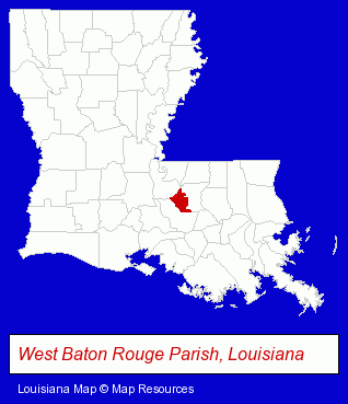
The Louisiana counties map at upper right shows West Baton Rouge Parish, highlighted in red. Use the menu below to display interactive maps of Port Allen, either in a frame on this page or in full-screen mode.
Use the menu below to display categorized Port Allen directories.
| Port Allen Directory Page: | Building Contractors |
|---|
Selected Port Allen, Louisiana Listings
These Port Allen listings provide some insight into the city's cultural environment and economic climate.- Builders & Contractors
- Building Contractors
- Government Contractors
- Schools
- Builders & Contractors
- Building Contractors
- Builders & Contractors
- Building Contractors
- Grocery Stores & Supermarkets
- Physicians & Surgeons
- Family & General Practice Physicians & Surgeons
- General Practice
- Occupational & Industrial Medicine Physicians & Surgeons
- Home Improvement & Maintenance
- Plumbing Contractors
- Metals
- Metal Fabricators
- Roofing Contractors
- Metal Fabricators
- Sheet Metal Contractors
- Government Contractors
- Security Consultants & Agencies
Nearby Louisiana Cities and Towns *
- Baton Rouge (95) - Baton Rouge, Louisiana products & services directory.
- Gonzales (2) - Gonzales, Louisiana information and maps.
- Hammond (9) - Hammond, Louisiana demographics and directory.
- Lafayette (47) - Lafayette, Louisiana products & services directory.
- New Iberia (5) - New Iberia, Louisiana demographics and maps.
- Ponchatoula (1) - Ponchatoula, Louisiana information and maps.
- Thibodaux (3) - Thibodaux, Louisiana information and maps.
* Parenthesized numbers indicate economic activity levels.
Copyright © 2011-2026 RegionalDirectory.us. All rights reserved.