Hammond, Louisiana Map and Directory
Regional Directory > States Menu > Louisiana
 According to the United States Census Bureau, Hammond is a City that is located in Tangipahoa Parish, Louisiana at 30.50 degrees North and 90.46 degrees West.
The city's time zone is America/Chicago, and the city's primary telephone area code is 985.
The land area of Hammond is about 14.03 square miles, whereas the water area of the city is about 0.00 square miles.
Tangipahoa Parish's land area is about 791 square miles, so the city occupies about 1.8 percent of the county's total land area.
According to the United States Census Bureau, Hammond is a City that is located in Tangipahoa Parish, Louisiana at 30.50 degrees North and 90.46 degrees West.
The city's time zone is America/Chicago, and the city's primary telephone area code is 985.
The land area of Hammond is about 14.03 square miles, whereas the water area of the city is about 0.00 square miles.
Tangipahoa Parish's land area is about 791 square miles, so the city occupies about 1.8 percent of the county's total land area.
The Census Bureau estimates that Hammond had about 21,437 residents in 2019, which is approximately 1,528 people per square mile of land area.
According to recent American Community Survey data, the median household income in Hammond was about $36,921 per year.
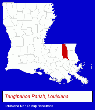
The Louisiana counties map at upper right shows Tangipahoa Parish, highlighted in red. Use the menu below to display interactive maps of Hammond, either in a frame on this page or in full-screen mode.
Use the menu below to display categorized Hammond directories.
| Hammond Products and Services Directory | ||
|---|---|---|
| Attorneys | Auto Dealers | Auto Service |
| Dentists | Escrow Services | Personal Injury Attorneys |
| Physicians | Sporting Goods Dealers | Title Insurance |
Selected Hammond, Louisiana Listings
These randomly selected Hammond listings provide some insight into the city's cultural environment and economic climate.- Drug Stores & Pharmacies
- Business Insurance
- Motorcycle Insurance
- Notaries Public
- Movers
- Household Goods & Furniture Storage
- Tool Rental & Leasing
- Storage Sheds & Buildings
- Portable Buildings
- Insurance
- Importers
- Musical Instruments Retail
- Pianos & Organs Retail
- Recycling Centers
- Scrap Iron & Metals
- Insurance
- Auto Insurance
- Property & Casualty Insurance
- Builders & Contractors
- Building Contractors
- Government Contractors
- Metal Buildings Dealers
- General Practice
- Cardiology Physicians & Surgeons
- Home Improvement & Maintenance
- Building & Home Construction
- Architects
- Architectural Services
- Interior Decorators & Designers
- Advertising
- Radio Stations
- Advertising Production Services
- Television & Radio Advertising Production
- Restaurants
- Banquet Facilities
- Bed & Breakfasts
- Wedding Receptions & Parties
- Sporting Goods
- Football Clubs & Instruction
- Cutting Tools Wholesale & Manufacturers
- Corporate Business Attorneys
- Personal Injury Attorneys
- Estate Planning & Administration Attorneys
- Real Estate Attorneys
- Builders & Contractors
- Building Contractors
Nearby Louisiana Cities and Towns *
- Baton Rouge (95) - Baton Rouge, Louisiana products & services directory.
- Covington (14) - Covington, Louisiana demographics and directory.
- Gonzales (2) - Gonzales, Louisiana information and maps.
- Kenner (10) - Kenner, Louisiana demographics and directory.
- Mandeville (16) - Mandeville, Louisiana demographics and directory.
- Metairie (48) - Metairie, Louisiana products & services directory.
- New Orleans (76) - New Orleans, Louisiana products & services directory.
* Parenthesized numbers indicate economic activity levels.
Copyright © 2011-2026 RegionalDirectory.us. All rights reserved.