Vineyard Haven, Massachusetts Map and Directory
Regional Directory > States Menu > Massachusetts
 According to the United States Census Bureau, Vineyard Haven is a Census-designated Place that is located in Dukes County, Massachusetts at 41.45 degrees North and 70.60 degrees West.
The place's time zone is America/New York, and the place's primary telephone area code is 774.
The land area of Vineyard Haven is about 1.23 square miles, whereas the water area of the place is about 0.33 square miles.
Dukes County's land area is about 103 square miles, so the place occupies about 1.2 percent of the county's total land area.
According to the United States Census Bureau, Vineyard Haven is a Census-designated Place that is located in Dukes County, Massachusetts at 41.45 degrees North and 70.60 degrees West.
The place's time zone is America/New York, and the place's primary telephone area code is 774.
The land area of Vineyard Haven is about 1.23 square miles, whereas the water area of the place is about 0.33 square miles.
Dukes County's land area is about 103 square miles, so the place occupies about 1.2 percent of the county's total land area.
The Census Bureau estimates that Vineyard Haven had about 2,384 residents in 2014, which is approximately 1,938 people per square mile of land area.
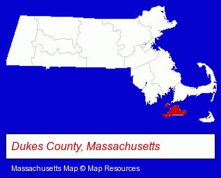
The Massachusetts counties map at upper right shows Dukes County, highlighted in red. Use the menu below to display interactive maps of Vineyard Haven, either in a frame on this page or in full-screen mode.
Use the menu below to display categorized Vineyard Haven directories.
| Vineyard Haven Directory Page: | Visual Arts |
|---|
Selected Vineyard Haven, Massachusetts Listings
These Vineyard Haven listings provide some insight into the place's cultural environment and economic climate.- Clothing Stores
- Water Sports Equipment & Supplies Dealers
- Elder Care
- Assisted Living Facilities
- Churches
- Restaurants
- Synagogues & Temples
- Airports
- Transportation Authorities, Brokers & Consultants
- Building Contractors
- Architects
- Architectural Engineers
- Sports & Recreation Facilities
- Health Clubs & Gyms
- Business Services
- Business Consultants & Advisors
- General Real Estate
- Auctions
- Real Estate Buyer Brokers
- Vineyards
- Civil Engineers
- Alternative Medicine
- Chiropractors
- Alternative Medicine Practitioners
- Builders & Contractors
- Building Contractors
- Notions Wholesale & Manufacturers
- Cultural Attractions, Events & Facilities
- Libraries
Nearby Massachusetts Cities and Towns *
- Buzzards Bay (1) - Buzzards Bay, Massachusetts information and maps.
- Edgartown (2) - Edgartown, Massachusetts information and maps.
- Mattapoisett (1) - Mattapoisett, Massachusetts information and maps.
- New Bedford (15) - New Bedford, Massachusetts demographics and directory.
- Sandwich (3) - Sandwich, Massachusetts information and maps.
- Wareham (1) - Wareham, Massachusetts information and maps.
* Parenthesized numbers indicate economic activity levels.
Copyright © 2011-2026 RegionalDirectory.us. All rights reserved.