Framingham, Massachusetts Map and Directory
Regional Directory > States Menu > Massachusetts
 According to the United States Census Bureau, Framingham is a Town that is located in Middlesex County, Massachusetts at 42.31 degrees North and 71.44 degrees West.
The town's time zone is America/New York, and the town's primary telephone area code is 774.
The land area of Framingham is about 25.04 square miles, whereas the water area of the town is about 1.46 square miles.
Middlesex County's land area is about 818 square miles, so the town occupies about 3.1 percent of the county's total land area.
According to the United States Census Bureau, Framingham is a Town that is located in Middlesex County, Massachusetts at 42.31 degrees North and 71.44 degrees West.
The town's time zone is America/New York, and the town's primary telephone area code is 774.
The land area of Framingham is about 25.04 square miles, whereas the water area of the town is about 1.46 square miles.
Middlesex County's land area is about 818 square miles, so the town occupies about 3.1 percent of the county's total land area.
The Census Bureau estimates that Framingham had about 74,416 residents in 2019, which is approximately 2,972 people per square mile of land area.
According to recent American Community Survey data, the median household income in Framingham was about $82,709 per year. This Framingham Real Estate directory lists real estate solution providers in Framingham, Massachusetts.
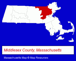
The Massachusetts counties map at upper right shows Middlesex County, highlighted in red. Use the menu below to display interactive maps of Framingham, either in a frame on this page or in full-screen mode.
Use the menu below to display categorized Framingham directories.
| Framingham Products and Services Directory | ||
|---|---|---|
| Accountants | Attorneys | Auto Service |
| Building Contractors | Business Services | Clinics |
| Dentists | Home Improvement | Insurance |
| Landscape Contractors | Physicians | Restaurants |
| Schools | ||
Selected Framingham, Massachusetts Listings
These randomly selected Framingham listings provide some insight into the town's cultural environment and economic climate.- Chiropractors
- Chiropractic Clinics
- Human Resources
- Career Planning & Employment Assistance Services
- Fabric Shops
- Textiles Retail
- Furniture Refinishing & Repair
- Upholstery Fabrics Retail
- Certified Public Accountants
- Funeral Services
- Funeral Homes & Directors
- Funeral Planning
- Golf Equipment & Supplies Retail
- Rehabilitation Services
- Rehabilitation Centers
- Alcohol & Drug Abuse Information & Treatment
- Addiction Information & Treatment
- Endodontics Dentists
- Heating Contractors
- Heating & Air Conditioning Contractors
- Heating & Ventilating Contractors
- Pizza Restaurants
- Plumbing Contractors
- Heating & Ventilating Contractors
- Plumbing Service & Repair
- Gas Heating Equipment & Supplies
- Medical Equipment & Supplies Retail
- Hospital Supplies
Nearby Massachusetts Cities and Towns *
- Marlborough (17) - Marlborough, Massachusetts solutions directory and maps.
- Natick (11) - Natick, Massachusetts demographics and directory.
- Needham (9) - Needham, Massachusetts demographics and directory.
- Sudbury (7) - Sudbury, Massachusetts demographics and maps.
- Wayland (4) - Wayland, Massachusetts information and maps.
- Wellesley (6) - Wellesley, Massachusetts demographics and maps.
- Westborough (7) - Westborough, Massachusetts demographics and maps.
Large and Mid-size Cities in Nearby States
- Providence, Rhode Island (27) - Providence, RI solutions directory and maps.
- Nashua, New Hampshire (20) - Nashua, NH demographics and directory.
* Parenthesized numbers indicate economic activity levels.
Copyright © 2011-2026 RegionalDirectory.us. All rights reserved.