Wayland, Massachusetts Map and Directory
Regional Directory > States Menu > Massachusetts
 According to the United States Census Bureau, Wayland is a Town that is located in Middlesex County, Massachusetts at 42.36 degrees North and 71.36 degrees West.
The town's time zone is America/New York, and the town's primary telephone area code is 774.
The land area of Wayland is about 15.05 square miles, whereas the water area of the town is about 0.80 square miles.
Middlesex County's land area is about 818 square miles, so the town occupies about 1.8 percent of the county's total land area.
According to the United States Census Bureau, Wayland is a Town that is located in Middlesex County, Massachusetts at 42.36 degrees North and 71.36 degrees West.
The town's time zone is America/New York, and the town's primary telephone area code is 774.
The land area of Wayland is about 15.05 square miles, whereas the water area of the town is about 0.80 square miles.
Middlesex County's land area is about 818 square miles, so the town occupies about 1.8 percent of the county's total land area.
The Census Bureau estimates that Wayland had about 13,802 residents in 2019, which is approximately 917 people per square mile of land area.
According to recent American Community Survey data, the median household income in Wayland was about $185,375 per year.
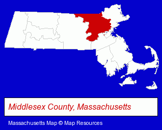
The Massachusetts counties map at upper right shows Middlesex County, highlighted in red. Use the menu below to display interactive maps of Wayland, either in a frame on this page or in full-screen mode.
Use the menu below to display categorized Wayland directories.
| Wayland Products and Services Directory | ||
|---|---|---|
| Dentists | Landscape Contractors | Restaurants |
| Schools | ||
Selected Wayland, Massachusetts Listings
These randomly selected Wayland listings provide some insight into the town's cultural environment and economic climate.- Jewelers
- Antiques
- Antique Dealers
- Antique Appraisers
- Insurance
- Insurance Consultants & Advisors
- Fireplaces & Accessories Retail
- Fireplaces & Accessories Retail
- Funeral Services
- Funeral Homes & Directors
- Cemeteries & Crematories
- Pre-Arranged Funeral Plans
- Funeral Planning
- Masonry Contractors
- Tree Services Commercial & Industrial
- Advertising
- Advertising & Promotional Product Dealers
- Advertising Specialties Wholesale & Manufacturers
- Advertising & Promotional Gifts
- Orthodontics Dentists
- Advertising Agencies & Consultants
- Financial Services
- Financing
- Veterinarians
- Animal Hospitals
- Small Animal Veterinarians
- Surgery Veterinarians
- Dentistry Veterinarians
- Veterinarians
- Landscape Equipment & Supplies Dealers
- Lawn & Garden Outdoor Power Equipment
- Lawn Mowers Retail
- Attorneys
Nearby Massachusetts Cities and Towns *
- Concord (10) - Concord, Massachusetts demographics and directory.
- Framingham (19) - Framingham, Massachusetts solutions directory and maps.
- Natick (11) - Natick, Massachusetts demographics and directory.
- Newton (11) - Newton, Massachusetts demographics and directory.
- Sudbury (7) - Sudbury, Massachusetts demographics and maps.
- Waltham (19) - Waltham, Massachusetts solutions directory and maps.
- Wellesley (6) - Wellesley, Massachusetts demographics and maps.
* Parenthesized numbers indicate economic activity levels.
Copyright © 2011-2026 RegionalDirectory.us. All rights reserved.