Rolla, Missouri Map and Directory
Regional Directory > States Menu > Missouri
 According to the United States Census Bureau, Rolla is a City that is located in Phelps County, Missouri at 37.95 degrees North and 91.77 degrees West.
The city's time zone is America/Chicago, and the city's primary telephone area code is 573.
The land area of Rolla is about 12.03 square miles, whereas the water area of the city is about 0.02 square miles.
Phelps County's land area is about 672 square miles, so the city occupies about 1.8 percent of the county's total land area.
According to the United States Census Bureau, Rolla is a City that is located in Phelps County, Missouri at 37.95 degrees North and 91.77 degrees West.
The city's time zone is America/Chicago, and the city's primary telephone area code is 573.
The land area of Rolla is about 12.03 square miles, whereas the water area of the city is about 0.02 square miles.
Phelps County's land area is about 672 square miles, so the city occupies about 1.8 percent of the county's total land area.
The Census Bureau estimates that Rolla had about 20,431 residents in 2019, which is approximately 1,698 people per square mile of land area.
According to recent American Community Survey data, the median household income in Rolla was about $37,600 per year.
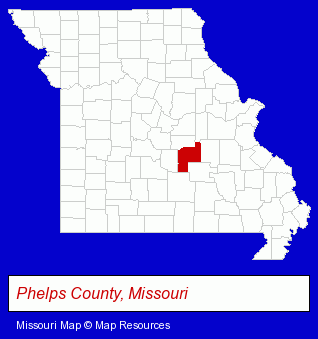
The Missouri counties map at upper right shows Phelps County, highlighted in red. Use the menu below to display interactive maps of Rolla, either in a frame on this page or in full-screen mode.
Use the menu below to display categorized Rolla directories.
| Rolla Products and Services Directory | ||
|---|---|---|
| Attorneys | Moving and Storage | Physicians |
Selected Rolla, Missouri Listings
These representative Rolla listings provide some insight into the city's cultural environment and economic climate.- Movers
- Household Goods & Furniture Storage
- Chiropractors
- Recreation Centers
- Bowling Alleys
- Movers
- Household Goods & Furniture Storage
- Trucking Companies
- Household Goods Moving & Storage
- Heating & Air Conditioning Contractors
- Air Conditioning Contractors
- Heating & Ventilating Contractors
- Air Conditioning Service & Repair
- Radio Stations
- Schools
- Colleges & Universities
- Sports & Recreation Facilities
- Stadiums & Arenas
- Alternative Medicine
- Chiropractors
- Alternative Medicine Practitioners
- Acupuncture & Acupressure
- Household Goods & Furniture Storage
- Household Goods Moving & Storage
- Mini & Self Storage
- Antiques
- Auctions
- Auctioneers & Auction Houses
- Cleaning Services
- Heating Contractors
- Air Conditioning Contractors
- Heating & Ventilating Contractors
- Furnaces & Heating Equipment Wholesale & Manufacturers
Nearby Missouri Cities and Towns *
- Columbia (28) - Columbia, Missouri solutions directory and maps.
- Hermann (1) - Hermann, Missouri information and maps.
- Jefferson City (18) - Jefferson City, Missouri solutions directory and maps.
- Osage Beach (7) - Osage Beach, Missouri demographics and maps.
- Sullivan (1) - Sullivan, Missouri information and maps.
* Parenthesized numbers indicate economic activity levels.
Copyright © 2011-2026 RegionalDirectory.us. All rights reserved.