Starkville, Mississippi Map and Directory
Regional Directory > States Menu > Mississippi
 According to the United States Census Bureau, Starkville is a City that is located in Oktibbeha County, Mississippi at 33.45 degrees North and 88.82 degrees West.
The city's time zone is America/Chicago, and the city's primary telephone area code is 662.
The land area of Starkville is about 25.51 square miles, whereas the water area of the city is about 0.11 square miles.
Oktibbeha County's land area is about 458 square miles, so the city occupies about 5.6 percent of the county's total land area.
According to the United States Census Bureau, Starkville is a City that is located in Oktibbeha County, Mississippi at 33.45 degrees North and 88.82 degrees West.
The city's time zone is America/Chicago, and the city's primary telephone area code is 662.
The land area of Starkville is about 25.51 square miles, whereas the water area of the city is about 0.11 square miles.
Oktibbeha County's land area is about 458 square miles, so the city occupies about 5.6 percent of the county's total land area.
The Census Bureau estimates that Starkville had about 25,653 residents in 2019, which is approximately 1,006 people per square mile of land area.
According to recent American Community Survey data, the median household income in Starkville was about $35,048 per year.
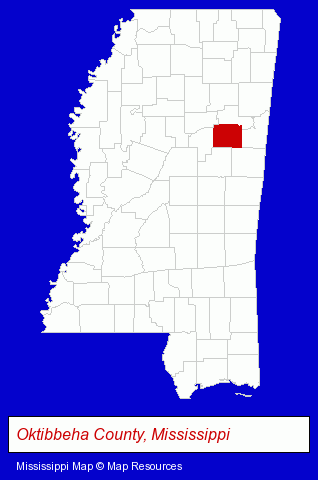
The Mississippi counties map at upper right shows Oktibbeha County, highlighted in red. Use the menu below to display interactive maps of Starkville, either in a frame on this page or in full-screen mode.
Use the menu below to display categorized Starkville directories.
| Starkville Directory Page: | Schools |
|---|
Selected Starkville, Mississippi Listings
These Starkville listings provide some insight into the city's cultural environment and economic climate.- Veterinarians
- Animal Health
- Antiques
- Antique Dealers
- Auto Glass Wholesale & Manufacturers
- Restaurants
- Pizza Restaurants
- Information Technology Services
- Computer Consultants
- Software Design & Development
- Computer Systems Integration
- Lawn & Garden Services
- Ornamental Shrub & Tree Services
- Tree Trimming Services
- Printing & Publishing
- Printing Services
- Publishers
- Newspaper Publishers
- Newspapers & Magazines
Nearby Mississippi Cities and Towns *
- Columbus (3) - Columbus, Mississippi information and maps.
- Jackson (20) - Jackson, Mississippi solutions directory and maps.
- Meridian (3) - Meridian, Mississippi information and maps.
- Mississippi State (1) - Mississippi State, Mississippi information and maps.
- Oxford (5) - Oxford, Mississippi demographics and maps.
- Tupelo (5) - Tupelo, Mississippi demographics and maps.
* Parenthesized numbers indicate economic activity levels.
Copyright © 2011-2026 RegionalDirectory.us. All rights reserved.