Hilo, Hawaii Map and Directory
Regional Directory > States Menu > Hawaii
 According to the United States Census Bureau, Hilo is a Census-designated Place that is located in Hawaii County, Hawaii at 19.72 degrees North and 155.09 degrees West.
The place's time zone is Pacific/Honolulu, and the place's primary telephone area code is 808.
The land area of Hilo is about 53.39 square miles, whereas the water area of the place is about 4.90 square miles.
Hawaii County's land area is about 4,028 square miles, so the place occupies about 1.3 percent of the county's total land area.
According to the United States Census Bureau, Hilo is a Census-designated Place that is located in Hawaii County, Hawaii at 19.72 degrees North and 155.09 degrees West.
The place's time zone is Pacific/Honolulu, and the place's primary telephone area code is 808.
The land area of Hilo is about 53.39 square miles, whereas the water area of the place is about 4.90 square miles.
Hawaii County's land area is about 4,028 square miles, so the place occupies about 1.3 percent of the county's total land area.
The Census Bureau estimates that Hilo had about 45,056 residents in 2019, which is approximately 844 people per square mile of land area.
According to recent American Community Survey data, the median household income in Hilo was about $63,283 per year. This Hilo Real Estate directory lists real estate solution providers in Hilo, Hawaii.
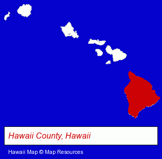
The Hawaii counties map at upper right shows Hawaii County, highlighted in red. Use the menu below to display interactive maps of Hilo, either in a frame on this page or in full-screen mode.
Use the menu below to display categorized Hilo directories.
| Hilo Products and Services Directory | ||
|---|---|---|
| Business Services | Clothing Stores | Hotels |
| Physicians | Schools | |
Selected Hilo, Hawaii Listings
These randomly selected Hilo listings provide some insight into the place's cultural environment and economic climate.- Business Consultants & Advisors
- Management Consultants
- Business Management Services
- Visual Arts
- Art Galleries & Dealers
- Florists
- Nurseries
- Flower Wholesalers
- Flower Growers & Shippers
- Radiology Physicians & Surgeons
- Grocery Stores & Supermarkets
- Public Schools
- Educational Services
- Educational Administration
- Restaurants
- Pizza Restaurants
Nearby Hawaii Cities and Towns *
- Honolulu (68) - Honolulu, Hawaii products & services directory.
- Kahului (3) - Kahului, Hawaii information and maps.
- Kihei (8) - Kihei, Hawaii demographics and maps.
- Lahaina (9) - Lahaina, Hawaii demographics and directory.
* Parenthesized numbers indicate economic activity levels.
Copyright © 2011-2026 RegionalDirectory.us. All rights reserved.