Lahaina, Hawaii Map and Directory
Regional Directory > States Menu > Hawaii
 According to the United States Census Bureau, Lahaina is a Census-designated Place that is located in Maui County, Hawaii at 20.87 degrees North and 156.68 degrees West.
The place's time zone is Pacific/Honolulu, and the place's primary telephone area code is 808.
The land area of Lahaina is about 7.78 square miles, whereas the water area of the place is about 1.51 square miles.
Maui County's land area is about 1,162 square miles, so the place occupies about 0.7 percent of the county's total land area.
According to the United States Census Bureau, Lahaina is a Census-designated Place that is located in Maui County, Hawaii at 20.87 degrees North and 156.68 degrees West.
The place's time zone is Pacific/Honolulu, and the place's primary telephone area code is 808.
The land area of Lahaina is about 7.78 square miles, whereas the water area of the place is about 1.51 square miles.
Maui County's land area is about 1,162 square miles, so the place occupies about 0.7 percent of the county's total land area.
The Census Bureau estimates that Lahaina had about 12,776 residents in 2019, which is approximately 1,642 people per square mile of land area.
According to recent American Community Survey data, the median household income in Lahaina was about $75,850 per year. This Lahaina Real Estate directory lists real estate solution providers in Lahaina, Hawaii.
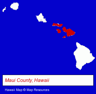
The Hawaii counties map at upper right shows Maui County, highlighted in red. Use the menu below to display interactive maps of Lahaina, either in a frame on this page or in full-screen mode.
Use the menu below to display categorized Lahaina directories.
| Lahaina Products and Services Directory | ||
|---|---|---|
| Coffee and Tea Shops | Diving Instruction | Hotels |
| Restaurants | Scuba Diving | Seafood Restaurants |
| Steak Restaurants | Vacation Home Rental | Water Sports |
Selected Lahaina, Hawaii Listings
These randomly selected Lahaina listings provide some insight into the place's cultural environment and economic climate.- Caterers
- Professional & Commercial Divers
- Diving Tours
- Clothing & Accessories Retail
- Shoe Stores
- Boots & Safety Shoes Retail
- Custom Shoes & Boots
- Lodging
- Hotels
- Motels
- Diving Equipment & Supplies
- Homes & Residential Real Estate
- Property Management
- Vacation Home Rental
- Tours & Charters
- Boat & Yacht Charters, Rental & Leasing
- Fishing
- Hunting Guides
Nearby Hawaii Cities and Towns *
- Hana (1) - Hana, Hawaii information and maps.
- Honolulu (68) - Honolulu, Hawaii products & services directory.
- Kahului (3) - Kahului, Hawaii information and maps.
- Kihei (8) - Kihei, Hawaii demographics and maps.
- Kula (1) - Kula, Hawaii information and maps.
- Makawao (1) - Makawao, Hawaii information and maps.
- Wailuku (2) - Wailuku, Hawaii information and maps.
* Parenthesized numbers indicate economic activity levels.
Copyright © 2011-2026 RegionalDirectory.us. All rights reserved.