Kahului, Hawaii Map and Directory
Regional Directory > States Menu > Hawaii
 According to the United States Census Bureau, Kahului is a Census-designated Place that is located in Maui County, Hawaii at 20.88 degrees North and 156.47 degrees West.
The place's time zone is Pacific/Honolulu, and the place's primary telephone area code is 808.
The land area of Kahului is about 14.45 square miles, whereas the water area of the place is about 1.64 square miles.
Maui County's land area is about 1,162 square miles, so the place occupies about 1.2 percent of the county's total land area.
According to the United States Census Bureau, Kahului is a Census-designated Place that is located in Maui County, Hawaii at 20.88 degrees North and 156.47 degrees West.
The place's time zone is Pacific/Honolulu, and the place's primary telephone area code is 808.
The land area of Kahului is about 14.45 square miles, whereas the water area of the place is about 1.64 square miles.
Maui County's land area is about 1,162 square miles, so the place occupies about 1.2 percent of the county's total land area.
The Census Bureau estimates that Kahului had about 31,336 residents in 2019, which is approximately 2,169 people per square mile of land area.
According to recent American Community Survey data, the median household income in Kahului was about $86,129 per year.
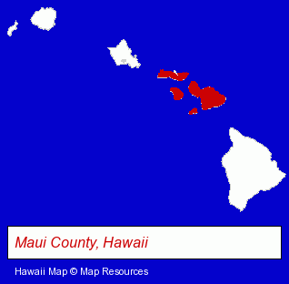
The Hawaii counties map at upper right shows Maui County, highlighted in red. Use the menu below to display interactive maps of Kahului, either in a frame on this page or in full-screen mode.
Use the menu below to display categorized Kahului directories.
| Kahului Products and Services Directory | ||
|---|---|---|
| Air Transportation | Auto Rental | Clothing Stores |
Selected Kahului, Hawaii Listings
These representative Kahului listings provide some insight into the place's cultural environment and economic climate.- Television Stations
- Television Stations
- Energy & Environment
- Recycling Services, Equipment & Supplies
- Recycling Centers
- Physicians & Surgeons
- Alternative Medicine
- Chiropractors
- Alternative Medicine Practitioners
- Holistic Health Practitioners
- Banks
- Mortgages
- Real Estate Loans
- Building & Home Construction
- Special Trades Contractors
- Painting Contractors
- Painting Contractors Commercial & Industrial
- Outdoor Sports & Recreation
- Raft Trips & Tours
- Bicycle Tours
- Schools
- Preschools & Kindergartens
- Truck Equipment, Parts & Accessories Retail
- Diesel Engine Parts, Sales & Service
- Auto Parts Retail
- Truck Equipment, Parts & Accessories Retail
- Tires Retail
- Truck Tires
- Truck Dealers
- Used Cars
- Used Trucks
- Physicians & Surgeons
- Osteopathic Physicians & Surgeons
- Cosmetic & Reconstructive Surgeons
- Tours & Charters
- Air Transportation
- Air Sightseeing Tours
Nearby Hawaii Cities and Towns *
- Hana (1) - Hana, Hawaii information and maps.
- Honolulu (68) - Honolulu, Hawaii products & services directory.
- Kihei (8) - Kihei, Hawaii demographics and maps.
- Kula (1) - Kula, Hawaii information and maps.
- Lahaina (9) - Lahaina, Hawaii demographics and directory.
- Makawao (1) - Makawao, Hawaii information and maps.
- Wailuku (2) - Wailuku, Hawaii information and maps.
* Parenthesized numbers indicate economic activity levels.
Copyright © 2011-2026 RegionalDirectory.us. All rights reserved.